 GPlates is a free desktop software for the interactive visualisation of plate-tectonics. The compilation and documentation of GPlates 1.5 data was primarily funded by AuScope National Collaborative Research Infrastructure (NCRIS).
GPlates is developed by an international team of scientists and professional software developers at the EarthByte Project (part of AuScope) at the University of Sydney, the Division of Geological and Planetary Sciences (GPS) at CalTech, the Geodynamics team at the Geological Survey of Norway (NGU) and the Centre for Earth Evolution and Dynamics (CEED) at the University of Oslo.
Data by the EarthByte Group is licensed under a Creative Commons Attribution 3.0 Unported License. Please cite the references listed on this page when using GPlates 1.5 data sets.
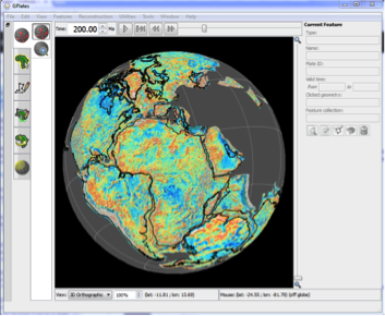
Download the latest version of GPlates here – link
View the latest GPlates user manual here – link
Download the latest GPlates tutorials here – link
Download standard file formats for GPlates here – link
Download list of plate IDs used in GPlates here – pdf
Read GPlates News, a quarterly update available here
GPlates-compatible data files – Features
Below is a list of GPlates-compatible data files that can be loaded seamlessly in GPlates. The feature data are available as .gpml (GPlates Markup Language), .dat (PLATES4), .shp (ESRI Shapefile) and .xy (long, lat with header record) formats.
| Feature | File | Source |
|---|---|---|
| EarthByte Global Rotation Model | Download - zip file | Data information |
| EarthByte Coastlines | Download - zip file | Data information |
| EarthByte Continental Polygons | Download - zip file | Data information |
| EarthByte Global Continent-Ocean Boundaries | Download - zip file | Data information |
| EarthByte Dynamic Polygons | Download - zip file | Data information |
| EarthByte Flowlines | Download - zip file | Data information |
| EarthByte Gridmarks | Download - zip file | Data information |
| EarthByte Hotspots | Download - zip file | Data information |
| EarthByte Isochron File | Download - zip file | Data information |
| EarthByte Paleomagnetic Data | Download - zip file | Data information |
| EarthByte Seafloor Fabric | Download - zip file | Data information |
| EarthByte Global Spreading Ridge File | Download - zip file | Data information |
| EarthByte Static Polygons | Download - zip file | Data information |
GPlates-compatible data files – Rasters
Below is a list of GPlates-compatible present-day rasters and time-dependent raster images that can be loaded seamlessly in GPlates. The raster data are available as a series of jpgs.
| Raster | File | Source |
|---|---|---|
| Global Present Day Agegrid | Download - zip file | Data information |
| Global Topography | Download - zip file | Data information |
| Global Free Air Gravity Anomalies | Download - zip file | Data information |
| Vertical Gravity Gradient (VGG) | Download - zip file | Data information |
| Global Magnetic Anomalies (WDMAM) | Download - zip file | Data information |
Time-dependent Rasters
| Raster | File | Source |
|---|---|---|
| Global Time-dependent Age Grid | Download - zip file | Data information |
| Global Time-dependent Dynamic Topography Files (0-70 Ma) | Download - zip file | Data information |
Colour Palette (CPT) Files
Included in the GPlates sample data are six Generic Mapping Tools (GMT) compatible colour palettes that can be used in GPlates. These included seafloor age, feature age, isochrons and ridges and plate ID – categorical and regular.
About the GPlates 1.5 Sample Data
GPlates 1.5 is packaged with a range of sample data sets that allow users to quickly and easily get up-and-running with plate tectonic reconstructions.
The below information details the sources of these data and relevant citations. Data by the EarthByte Group is licensed under a Creative Commons Attribution 3.0 Unported License. When using GPlates and the sample data to make figures for publications, we recommend citing the original data sources as indicated below.
Feature Collections
EarthByte Global Rotation Model
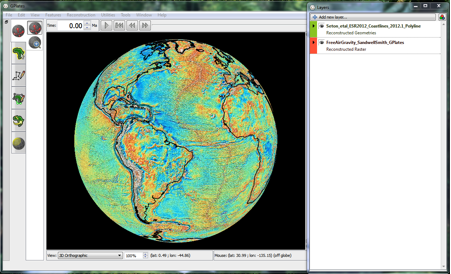
The sample data includes the Seton et al. (2012) rotation file, which contains a compilation of reconstruction poles that describe the motions of the continents and oceans. These rotations are a synthesis of many previous studies; each line in the rotation file lists the original source of the corresponding pole of rotation. Many of these original sources are listed within the Seton et al. (2012) paper listed below.
The feature data provided (detailed below) are compatible with this rotation file.
Citation:
Seton, M., Müller, R.D., Zahirovic, S., Gaina, C., Torsvik, T. H., Shephard, G., Talsma, A., Gurnis, M., Turner, M., Maus, S., and Chandler, M. 2012. Global continental and ocean basin reconstructions since 200 Ma, Earth-Science Reviews, 113: 212-270, DOI: 10.1016/j.earscirev.2012.03.002.
Download EarthByte Global Rotation Model from the Features list
EarthByte Coastlines
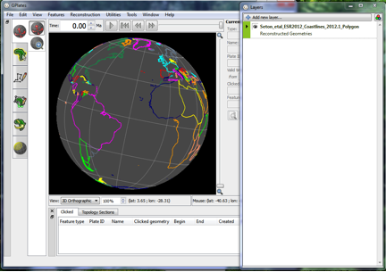 The coastline data is derived from the Global Self-consistent Hierarchical High-resolution Geography dataset (GSHHG), Version 2.3.3. This dataset is an amalgamation of three databases in the public domain: World Vector Shorelines (WVS), CIA World Data Bank II (WDBII), Atlas of the Cryosphere (AC).
The GSHHS coastline data exists in five resolutions: full, high, intermediate, low and crude – each successively reduced by 80%. These are available in PowerUser here.
In the Sample Data, the coastlines included are a simplified version of the high resolution GSHHS coastline. This simplification was done using ArcGIS with simplification tolerance of 0.05 decimal degrees (minimum Area: 100 Square km).
All coastlines in both the Sample Data and in PowerUser are consistent with Seton et al. 2012.
For more information on GSHHG click here.
Citations:
Bohlander, J. and Scambos, T. 2007. Antarctic coastlines and grounding line derived from MODIS Mosaic of Antarctica (MOA), Boulder, Colorado USA: National Snow and Ice Data Center.
Gorny, A. J. 1977. World Data Bank II General User GuideRep. PB 271869, 10pp, Central Intelligence Agency, Washington, DC.
Seton, M., Müller, R.D., Zahirovic, S., Gaina, C., Torsvik, T. H., Shephard, G., Talsma, A., Gurnis, M., Turner, M., Maus, S., and Chandler, M. 2012. Global continental and ocean basin reconstructions since 200 Ma, Earth-Science Reviews, 113: 212-270, DOI: 10.1016/j.earscirev.2012.03.002.
Soluri, E. A., and Woodson, V. A. 1990. World Vector Shoreline, Int. Hydrograph. Rev., LXVII(1), 27Ð35.
Wessel, P., and Smith, W. H. F. 1996. A global, self-consistent, hierarchical, high-resolution shoreline database, J. Geophysical Res., 101(B4), 8741Ð8743.
Download EarthByte Coastlines from the Features list
EarthByte Continental Polygons
The continental polygons are a set of data containing the continental lithosphere only (consistent with the static polygons described below). These are consistent with Seton et al. 2012.
Download EarthByte Continental Polygons from the Features list
EarthByte Global Continent-Ocean Boundaries
The present day Global Continent-Ocean Boundary (COB) Dataset are represented as lines along passive margins and do not include active margins. The timescales used are Cande and Kent 1995 and Gradstein et al. 1994. The COBs are consistent with Seton et al. 2012.
Download EarthByte Continent-Ocean Boundaries from the Features list
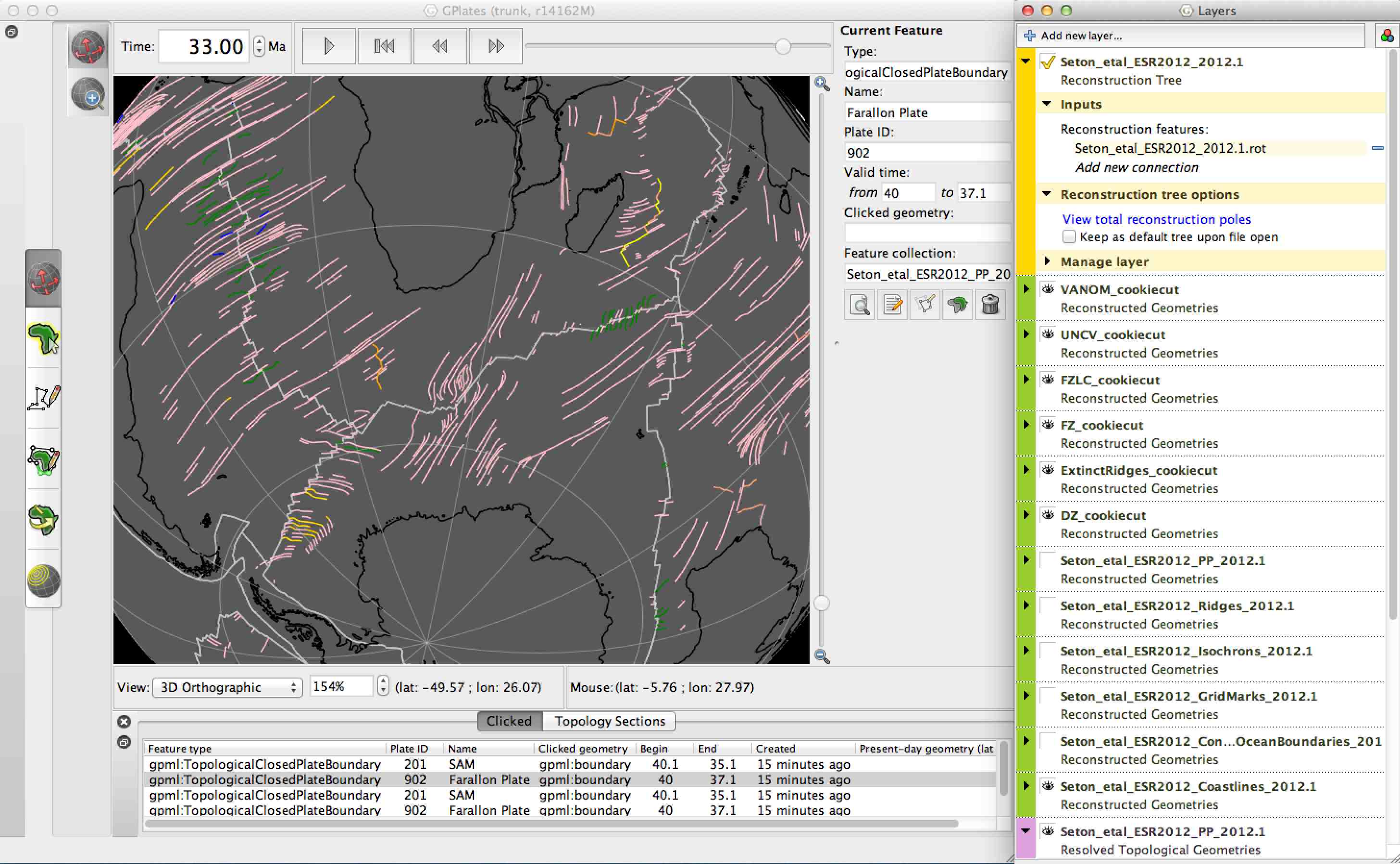
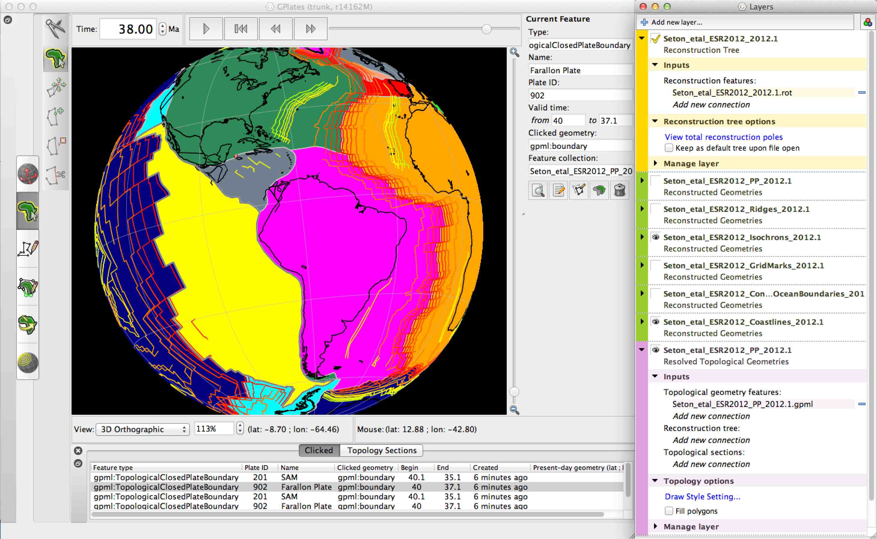
EarthByte Dynamic Polygons
A topological network of plate polygons with dynamic geometries are provided for the last 200 Ma. These data are provided in gpml (GPlates native) format and so require GPlates to be effectively visualised. Further information of this collection of data can be found here. The Dynamic polygons are consistent with Seton et al. 2012.
Download EarthByte Dynamic Polygons from the Features list
EarthByte Flowlines
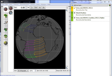 This directory contains examples of plate motion “flowlines” across the Atlantic Ocean that have been generated in GPlates. The directory contains a .gpml file which contains seed points at several locations along the Mid-Atlantic Ridge. When loaded with a rotation file the flowlines will be drawn to reflect the relative motion between the plate pair either side of the mid ocean ridge.
The flowlines will be reconstructed according to the rotation file that is loaded when they are opened but were created using a ridge axis location that is consistent with Seton et al. (2012).
Download EarthByte Flowlines from the Features list
EarthByte Grid Marks
The grid marks included in the Sample Data have been cookie-cut using the Seton et al. (2012) model.
Download EarthByte Grid Marks from the Features list
EarthByte Hotspots
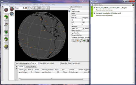 The hotspot/plume locations are represented as points and are split in Pacific and Indo/Atlantic domains. Locations were compiled from Montelli et al. (2004), Courtillot et al. (2003), Steinberger et al. (2000) and Anderson and Schramm (2005). Plumes closer than 500 km were combined into an averaged location.
Citation:
Whittaker, J. M., Williams, S. E., Masterton, S. M., Afonso, J. C., Seton, M., Landgrebe, T.C., Coffin, M.F., Müller, R.D. 2013. Interactions among plumes, mantle circulation and mid-ocean ridges, AGU Fall Meeting Abstracts.
Download EarthByte Hotspots from the Features list
EarthByte Isochron File
The isochrons are represented as lines and do not include reconstructed isochrons. The timescales used are Cande and Kent 1995 and Gradstein et al. 1994. They are consistent with Seton et al. (2012).
Download EarthByte Isochron File from the Features list
EarthByte Paleomagnetic Data
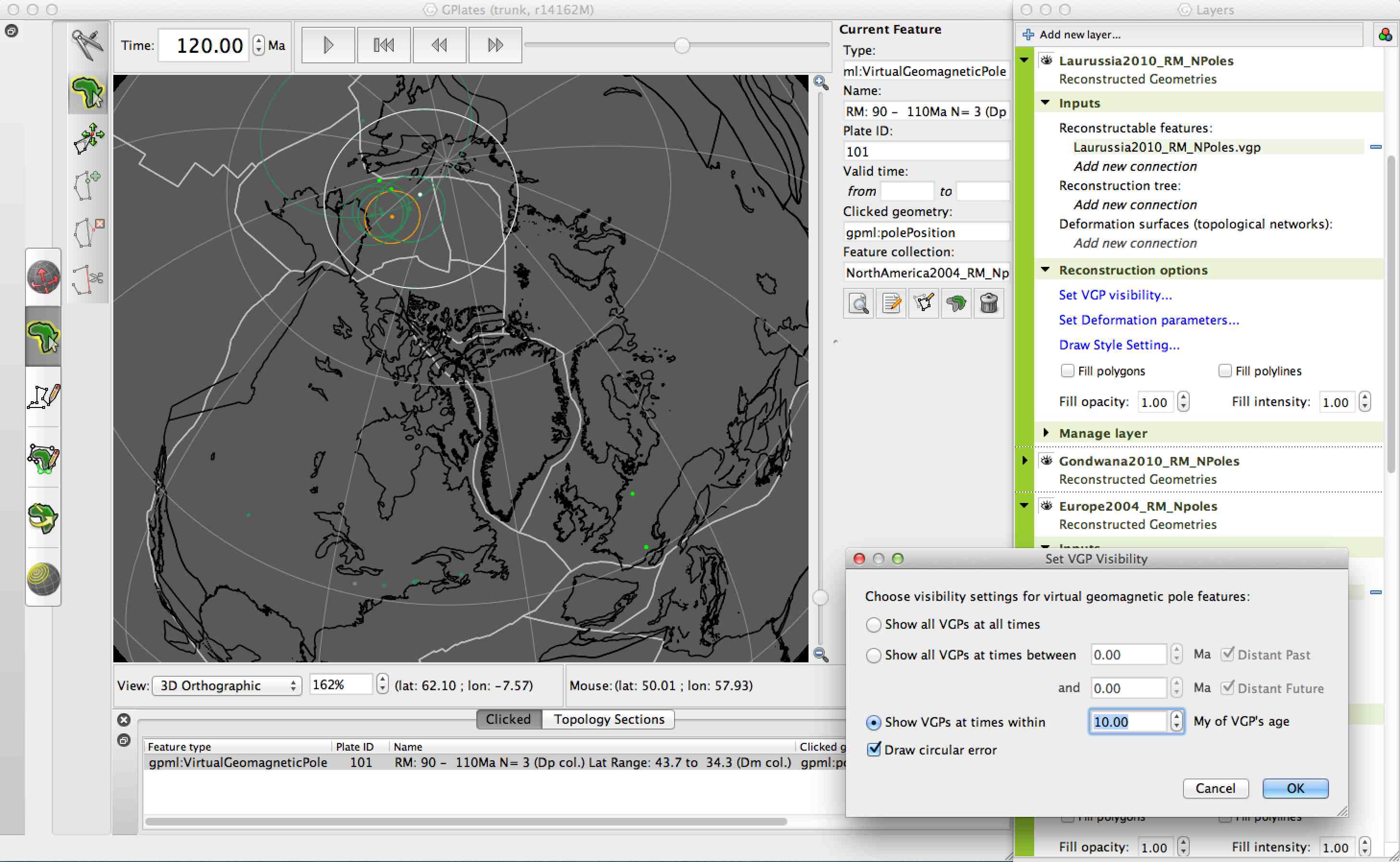 The paleomagnetism data sets are from the IAGA Global Paleomagnetic Database. The data are provided in GMAP VGP format, and GPML format. Both file formats can be read by GPlates.
Download EarthByte Paleomagnetic Data from the Features list
EarthByte Seafloor Fabric
 The ‘SeafloorFabric’ folder within the sample data contains a set of geometries that define the tectonic fabric of the world’s oceans. The data are taken from a global community data set of fracture zones (FZs), discordant zones, propagating ridges, V-shaped structures and extinct ridges, digitized from vertical gravity gradient (VGG) maps. More information on the tectonic fabric of the ocean basins can be found here.
Download EarthByte Seafloor Fabric from the Features list
Citation:
Matthews, K. J., Müller, R. D., Wessel, P., Whittaker, J. M. 2011. The tectonic fabric of the ocean basins, The Journal of Geophysical Research. Doi: 10.1029/2011JB008413.
EarthByte Global Spreading Ridge File
The Seton et al. (2012) spreading ridge dataset includes present day spreading ridges and extinct ridges, wich are represented as lines. The timescales used are Cande and Kent (1995) and Gradstein et al. (1994).
Citation: Seton et al. (2012).
Download EarthByte Global Spreading Ridge File from the Features list
EarthByte Static Polygons
 Static polygons allow plate IDs to be assigned to other sets of data and to reconstruct raster data. These polygons, and the set of isochrons defining the age of the ocean floor, are consistent with the grid of seafloor age described here.
Download EarthByte Static Polygons from the Features list
Rasters
Note: the resolution of the provided rasters has been limited to reduce the file size of the GPlates package. The original data sets are available in higher resolutions from links provided.
Global Present Day Agegrid
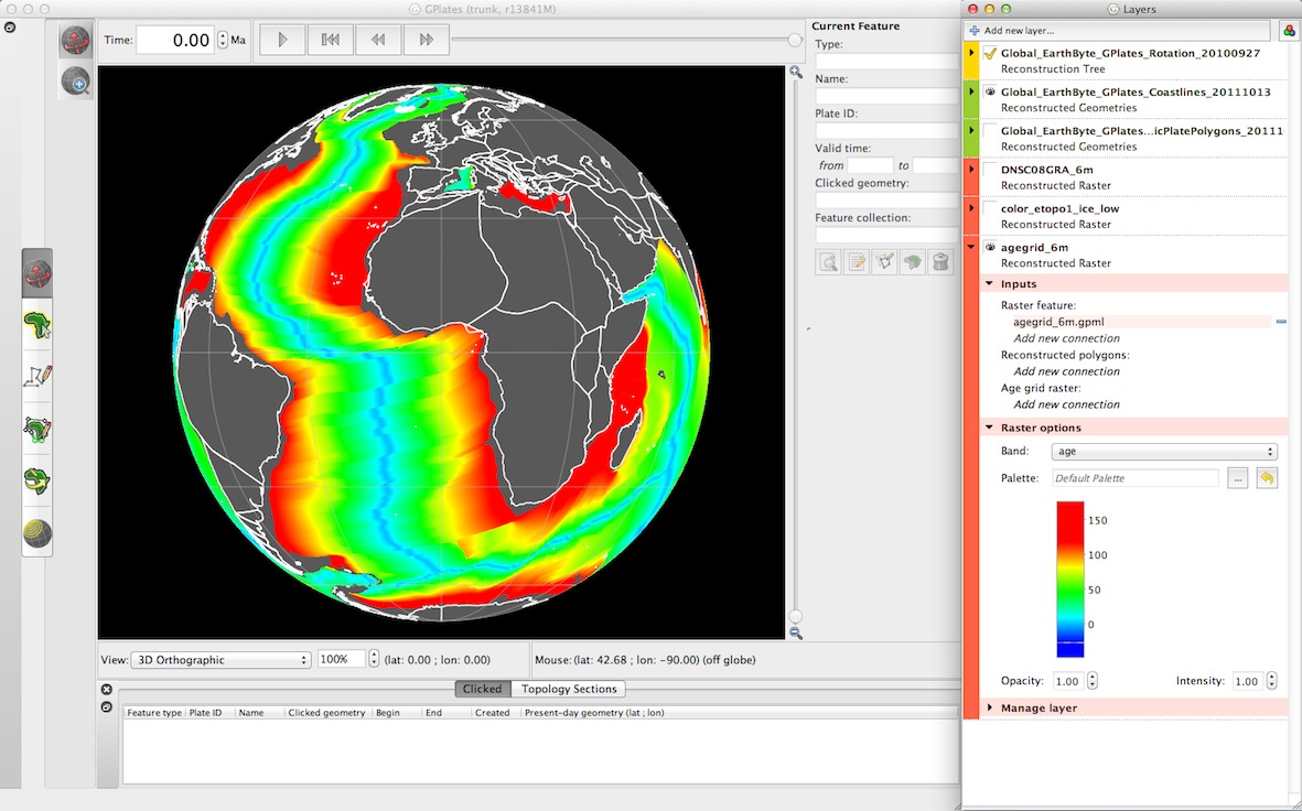 The sample data includes a 6-minute resolution grid of the age of the world’s ocean crust is produced by the Earthbyte group. More information, and a 2-minute resolution grid of the same data, can be found here.
Citation:
Müller, R.D., Sdrolias, M., Gaina, C. and Roest, W.R.. 2008. Age spreading rates and spreading asymmetry of the world’s ocean crust, Geochemistry, Geophysics, Geosystems, 9, Q04006. Doi: 10.1029/2007GC001743.
Download Global Present Day Agegrid from the Rasters list
Global Topography
 The color image of the ETOPO1 global relief model is available from the National Geophysical Data Center (NGDC). More information, and the original data in a variety of grid formats, can be found here.
Citation:
Amante, C. and Eakins, B. W. 2009. ETOPO1 1 Arc-Minute Global Relief Model: Procedures, Data Sources and Analysis. NOAA Technical Memorandum NESDIS NGDC-24, 19.
Download Global Topography from the Rasters list
Global Free Air Gravity Anomalies and Vertical Gravity Gradient (VGG)
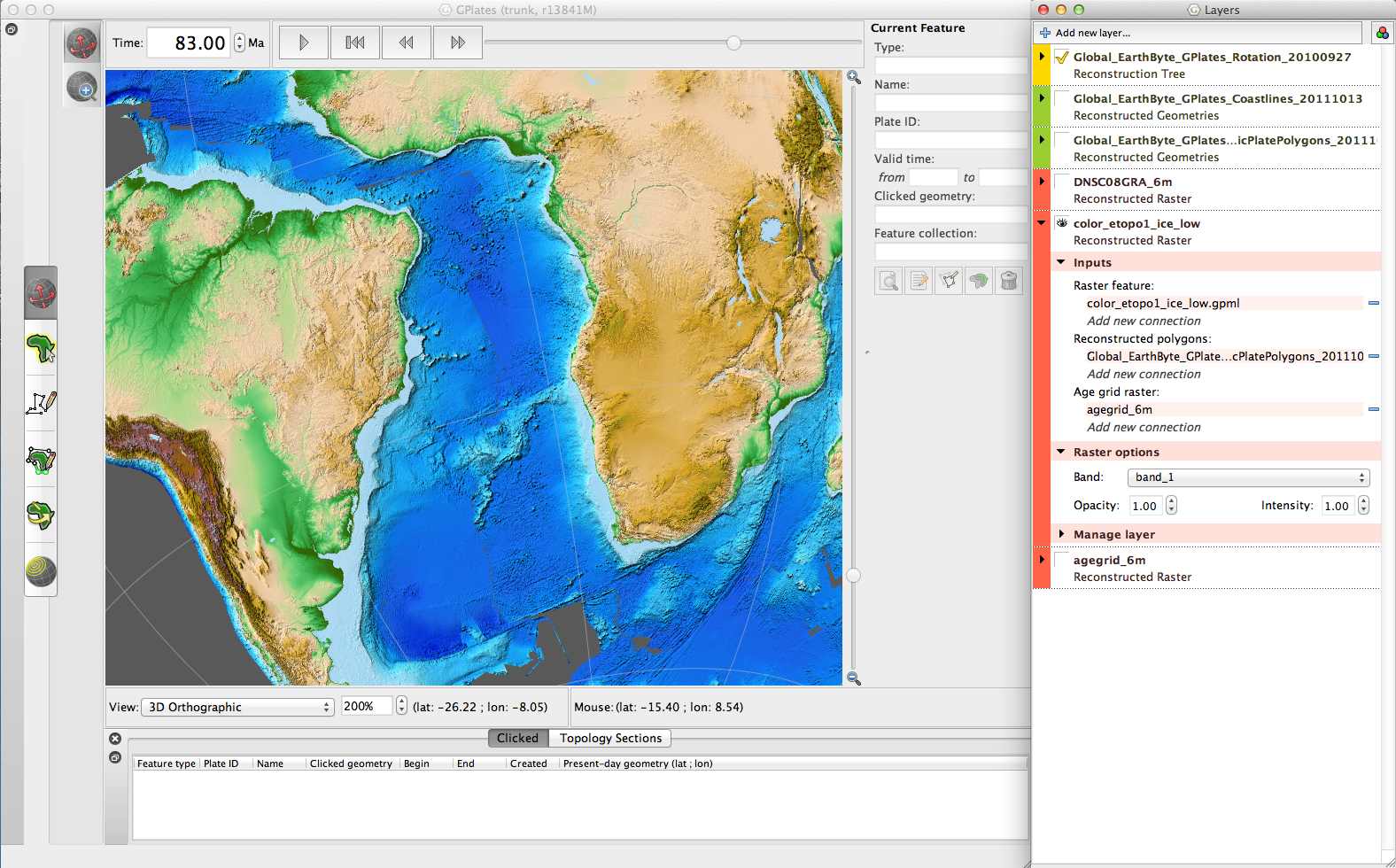
 The image of free air gravity is generated from Sandwell et al. (2014) and from the Danish National Space Centre (DNSC). In ploar regions, north of 80N and south of 80S the gravity anomalies are from the DNSC08. For latitudes within +/- 80 degrees, the gravity model of Sandwell et al. (2014) is used. The Vertical Gravity Gradient (VGG) grid is from Sandwell et al. (2014).
More information, as well as the original data sets in their full resolution, can be found here for the DNSC and here for Sandwell et al. (2014).
Citations:
Sandwell, D. T., Müller, R. D., Smith, W. H. F., Gracia, E. and Francis, E. 2014. New global marine gravity field model from CryoSat-2 and Jason-1 reveals buried tectonic structure. Science, Vol. 346 (6205), pp. 65-67. Doi: 10.1126/science.1258213.
Andersen, O. B., Knudsen, P. and Berry, P. 2010. The DNSC08GRA global marine gravity field from double retracked satellite altimetry, Journal of Geodesy, Volume 84, Number 3. DOI: 10.1007/s00190-009-0355-9.
Andersen, O. B., 2010. The DTU10 Gravity field and Mean sea surface. Second international symposium of the gravity field of the Earth (IGFS2), Fairbanks, Alaska.
Download Global Free Air Gravity Anomalies and/or VGG from the Rasters list
Global Magnetic Anomalies (WDMAM)
The World Magnetic Anomaly Map (WDMAM) project integrates all available near-surface and satellite magnetic anomaly data into a single gridded data set. More information, and the original data at full resolution, can be found here.
Citation:
Maus, S., Barckhausen, U., Berkenbosch, H., Bournas, N., Brozena, J., Childers, V., Dostaler, F., Fairhead, J. D., Finn, C., von Frese, R. R. B., Gaina, C., Golynsky, S., Kucks, R., Luhr, H., Milligan, P., Mogren, S., Müller, R. D., Olesen, O., Pilkington, M., Saltus, R., Schreckenberger, B., Thebault, E. and Caratori Tontini, F. 2009. EMAG2: A 2-arc-minute resolution Earth Magnetic Anomaly Grid compiled from satellite, airborne and marine magnetic measurements. Geochem. Geophys. Geosyst., doi:10.1029/2009GC002471.
Download Global Magnetic Anomalies from the Rasters list
Time-dependent Rasters
Global Time-dependent Age Grid
In addition to the present-day age grid raster there are a time-dependent series of jpgs showing the paleoage of the seafloor, reconstructed at 1 Ma intervals. More information, and links to download the data in the original grid format, can be found here.
Citation:
Müller, R.D., Sdrolias, M., Gaina, C. and Roest, W.R., 2008, Age spreading rates and spreading asymmetry of the world’s ocean crust, Geochemistry, Geophysics, Geosystems, 9, Q04006, doi:10.1029/2007GC001743.
Download Global Time-dependent Age Agrid from the Time-dependent Rasters list
Global Time-dependent Dynamic Topography Files (0-70 Ma)
A sequence of time-dependent global raster images (JPEG images, generated from GMT grid files of dynamic topography). The dynamic topography comes from the work of Bernhard Steinberger at NGU. The raster images were created by Robin Watson at NGU.
Citations:
Muller, R. D., Sdrolias, M., Gaina, C., Steinberger, B. & Heine, C., 2008. Long-term sea level fluctuations driven by ocean basin volume change, Science, 319, 1357–1362, doi:10.1126/science.1151540.
Ritsema, J. & van Heijst, H.J., 2000. Seismic imaging of structural heterogeneity in Earth’s mantle: Evidence for large-scale mantle flow, Sci. Progr., 83, 243–259.
![]()
