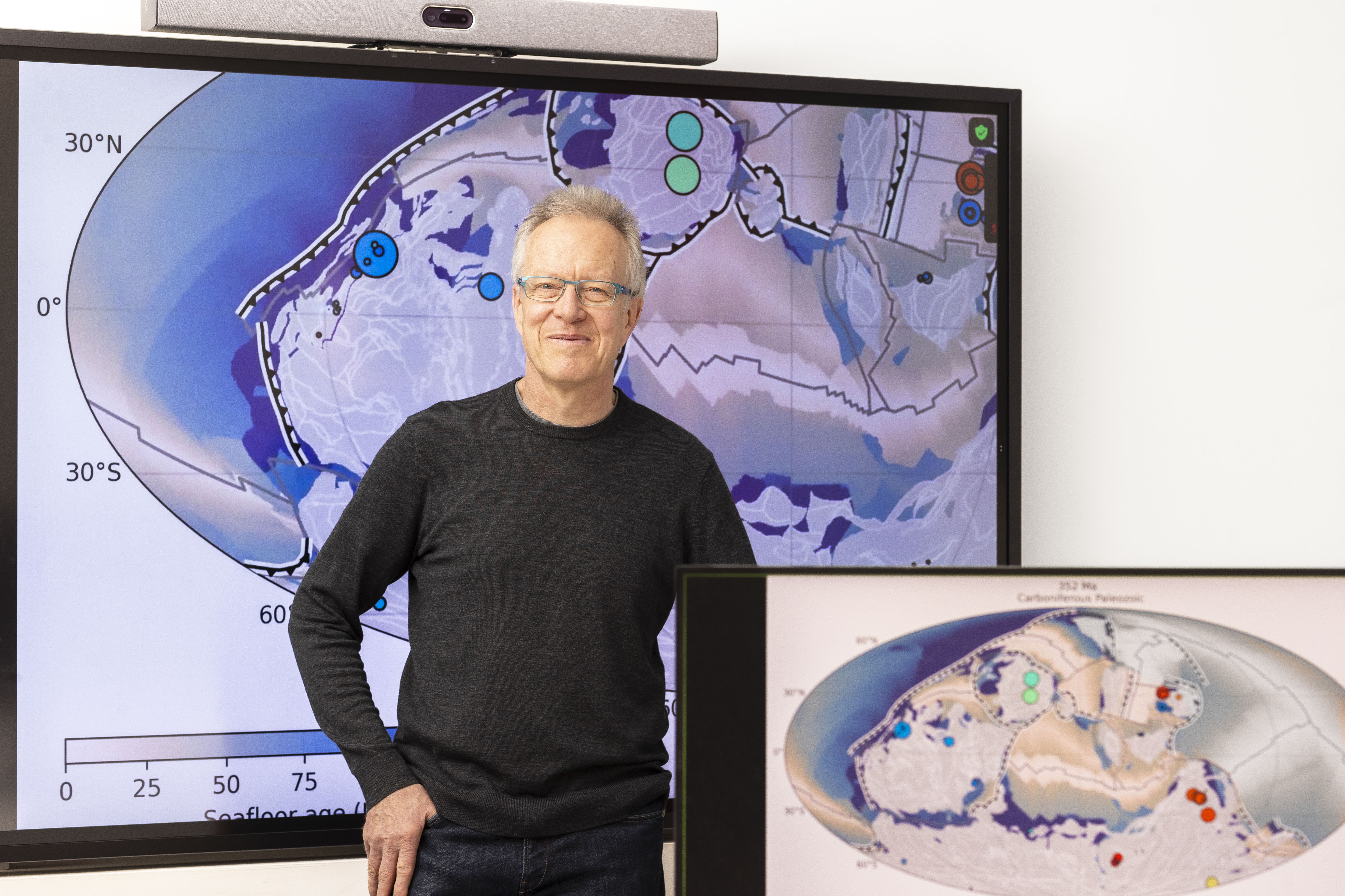
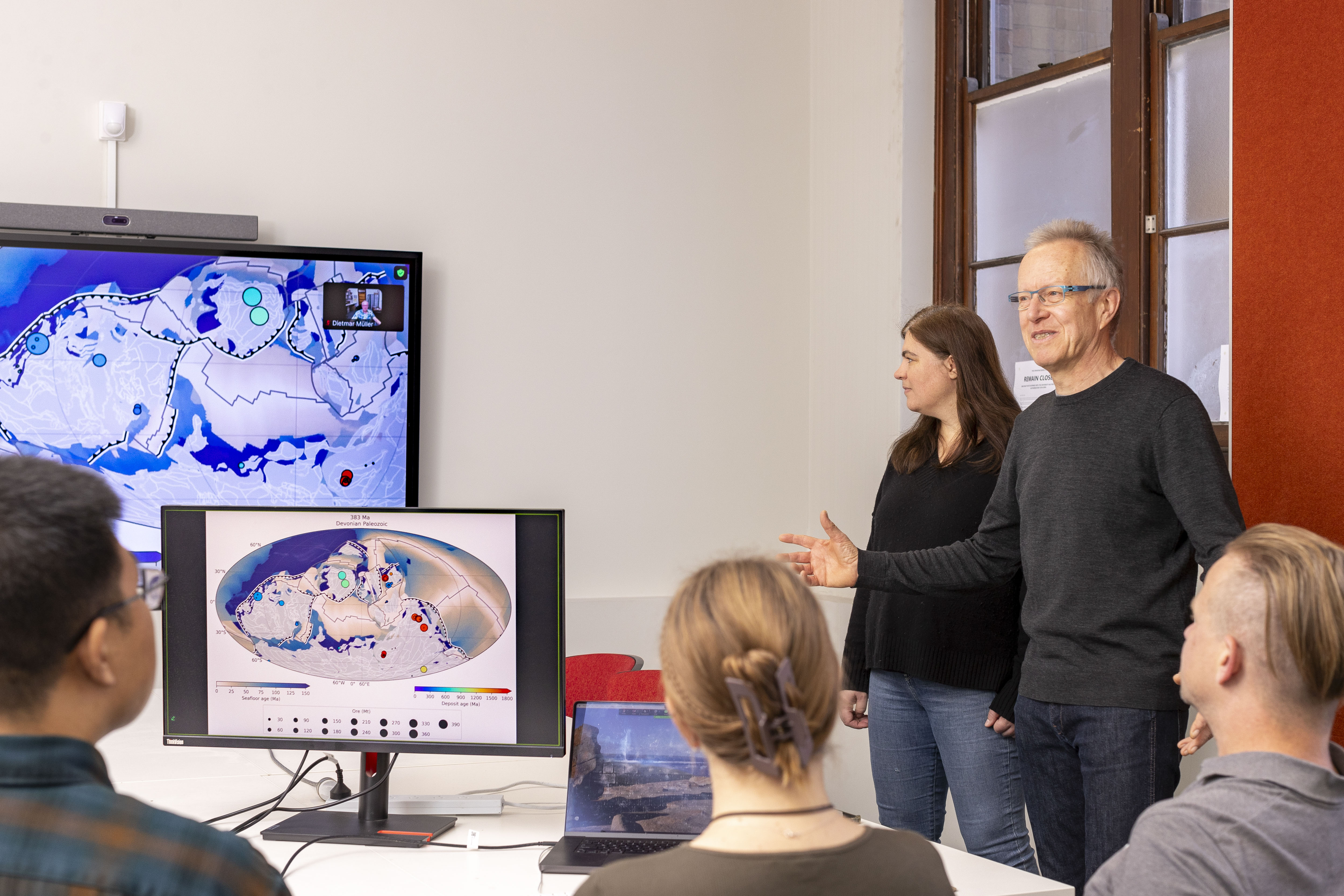
Professor Dietmar Müller leads the EarthByte Group, which builds a deep-time virtual Earth via geodata synthesis across space and time. The group aims to better understand the dynamic Earth, its paleogeography, and past climates. Its primary applied research focus is critical mineral exploration in the context of the energy transition.
“Understanding the Earth’s geological record is key to understanding our future. I build computer models that describe how the Earth’s tectonic plates have moved and changed shape over time. Our aim is to understand the planet’s interior evolution, surface environments, and mineral endowment through deep time on land and in the oceans,” says Dietmar.
EarthByte was established within the School of Geosciences at the University of Sydney in 2002 to bring together disparate geoscience information from around the world. The EarthByte Group fosters open innovation by developing collaborative software, utilising high-performance computing, analysing large-scale data, and providing open-access digital datasets to the public.
“Understanding the Earth’s geological record is key to understanding our future. I build computer models that describe how the Earth’s tectonic plates have moved and changed shape over time.”
Professor Dietmar Müller
Innovating for industry
The EartyByte group has led a range of industry transformation projects, including the ARC Basin Genesis Hub (BGH), a research centre supported by the Australian Research Council and industry partners, as well as numerous direct industry and ARC Linkage grants.
The BGH created a new ‘exploration geodynamics’ toolbox for industry, enhancing the capacity for innovation in software applications of exploration companies. Subsequent projects have advanced AI-powered deep-time exploration technologies to understand the geodynamic environments in which key critical mineral deposits have been created.
“An example of this is the STELLAR project with BHP in which we developed a spatio-temporal data mining method to map where and when copper deposits along the Earth’s subduction zones have been created and preserved through time,” says Dietmar.
The Group’s Model Atlas of the Earth showcases the power of the BGH exploration toolbox by offering a rich collection of numerical basin simulations. This growing set of simulations will help map vital resources like water, hydrogen, and critical minerals more effectively.
With its model visualisations and data, industry professionals can quickly analyse and interpret basin model data, improving exploration insights in challenging, data-scarce areas.
Technology for good
Dietmar recognised early on that open software held the key to transforming vast amounts of data into useful information by connecting geodata to a dynamic Earth model.
“GPlates, supported by the AuScope National Research Infrastructure, is a cross-platform plate tectonic geographic information system, which is now the de facto standard for reconstructing geodata in deep time. AuScope supplies the Australian and global geoscience community with research tools, data, analytics, and support. Without it, developing software with numerous industry translation pathways over two decades would have been impossible.
“GPlates is used by researchers at universities, industry, and government institutions in nearly all countries, leading to ~2000 community publications in journals and books. It has allowed us to become the global leader in this field,” says Dietmar.
In 2023, Dietmar was a finalist in the Australian Museum Eureka Prize for research software. “Most of my research would have been impossible without GPlates software,” says Dietmar.
Research with global impact and reach
The EartyByte teams used GPlates to compile data over many years to produce a model of how the Earth’s tectonic plates have moved over the last 1.8 billion years. In less than two minutes, the model shows how continents and plate boundaries have changed and moved over an unimaginably vast geological time period.
Antarctica, now a frozen, icy land, was once a warm, tropical spot near the equator. The model was featured in Forbes Magazine and numerous media outlets worldwide.
The model offers insights into past climate shifts, changes in ocean currents, and nutrient movement from Earth’s depths, which fuelled biological evolution. It unravels how Earth became a haven for complex life, emphasising the critical role of plate tectonics.
“This breakthrough research brings us closer to understanding how our planet evolved into a life-supporting world.”
GPlates model showing how the Earth’s tectonic plates have moved over the last 1.8 billion years.
![]()
