Traditional geological mapping methods, which rely on field observations and rock sample analysis, are inefficient for
continuous spatial mapping of geological features such as alteration zones. Deep learning models such as convolutional
neural networks (CNNs) have ushered in a transformative era in remote sensing data analysis. CNNs excel in automatically
extracting features from image data for classification and regression problems. CNNs have the ability to pinpoint specific
mineralogical changes attributed to mineralisation processes by discerning subtle features within remote sensing data.
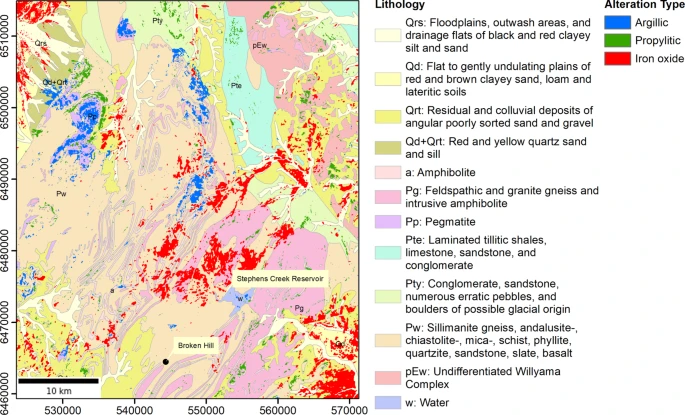
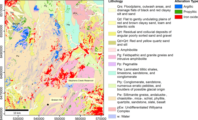
In this study, we deploy CNNs with three sets of remote sensing data, namely Landsat 8, Landsat 9, and ASTER,
to delineate diverse alteration zones within a mineral-rich region north of Broken Hill in western New South Wales,
Australia. Our methodology involves model training using two distinct sets of training samples generated through ground
truth data and a fully automated approach through selective principal component analysis (PCA). We also compare CNNs
with conventional machine learning models, including k-nearest neighbours, support vector machines, and multilayer
perceptron. Our findings indicate that training with a ground truth-based dataset produces more reliable alteration maps.
Additionally, we find that CNNs perform slightly better when compared to conventional machine learning models, which
further demonstrates the ability of CNNs to capture spatial patterns in remote sensing data effectively. We find that Landsat
9 surpasses Landsat 8 in mapping iron oxide areas when employing the CNNs model trained with ground truth data
obtained by field surveys. We also observe that using ASTER data with the CNNs model trained on the ground truth-based
dataset produces the most accurate maps for two other important types of alteration zones, argillic and propylitic. This
underscores the utility of CNNs in enhancing the efficiency and precision of geological mapping, particularly in discerning
subtle alterations indicative of mineralisation processes, especially those associated with critical metal resources.
Farahbakhsh, E., Goel, D., Pimparkar, D., Müller, R.D. and Chandra, R., 2025. Convolutional neural networks for mineral prospecting through alteration mapping with remote sensing data. PFG–Journal of Photogrammetry, Remote Sensing and Geoinformation Science, pp.1-22.
![]()
