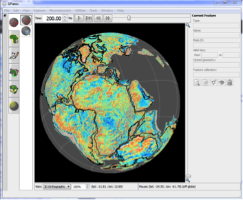
 GPlates 2.0 was released last week, with lots of new features including plate deformation, volume rendering, much improved project and session management, a plate topology building tool and an interactive tool to determine best-fit rotation poles using the method of Hellinger, and much more. Check out the full list of improvements here. … Read more…
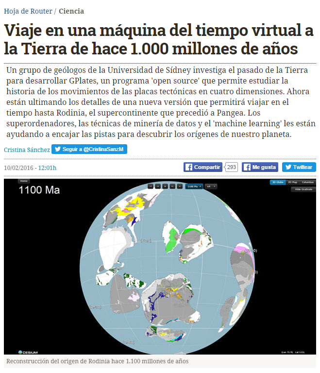
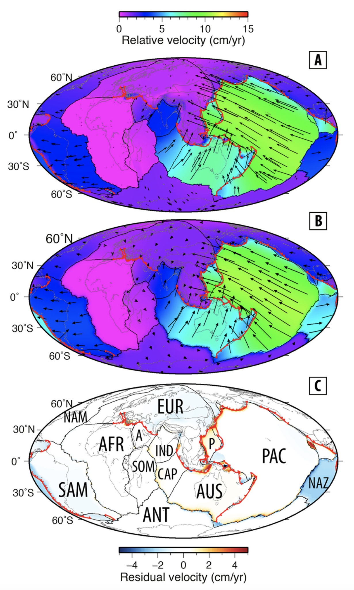
Kinematic constraints on the Rodinia to Gondwana transition
Author List: Andrew Merdith, Simon Williams, Dietmar Müller & Alan Collins. Citation: Merdith, Andrew & Williams, Simon & Müller, Dietmar & Collins, Alan. (2017). Kinematic constraints on the Rodinia-Gondwana transition. Precambrian Research. 299. . 10.1016/j.precamres.2017.07.013. Abstract: Earth’s plate tectonic history during the breakup of the supercontinent Pangea is well constrained from the seafloor spreading record, but evolving plate configurations during … Read more…