


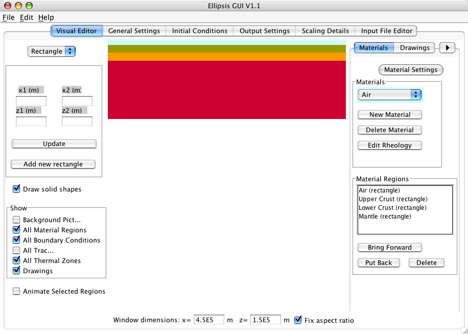
 Ellipsis is a lagrangian particle-in-cell finite element modelling software tool with an associated graphical user interface (GUI). Ellipsis, along with its GUI and its associated documentation allow novice users to assemble 2D or 3D numerical experiment for lithospheric extension and/or compression over a convecting mantle or simply run a mantle convection experiment with or without continents in a relatively short time, including the scaling of relevant parameters. … Read more…
PyBacktrack1.5 released
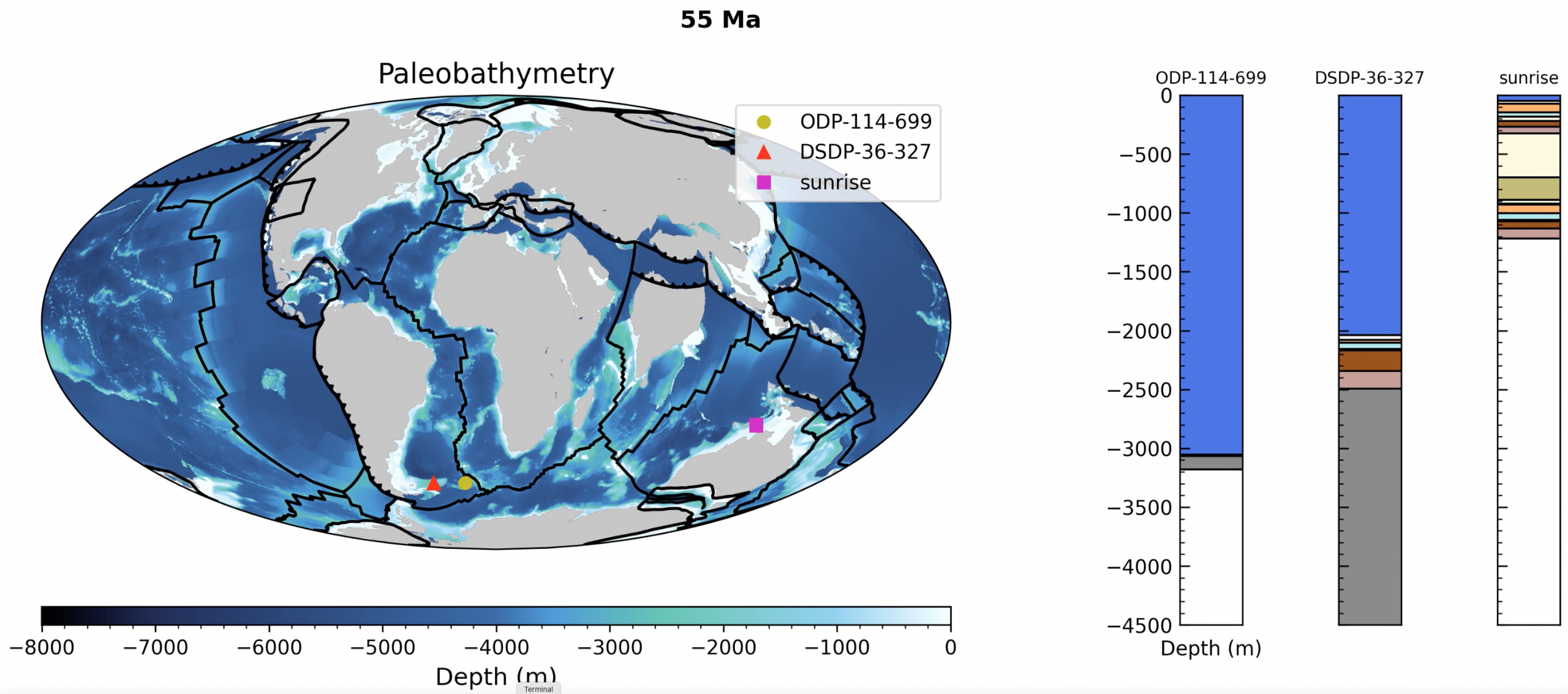
🚀 pyBacktrack 1.5 is now released! The new release makes pyBacktrack easier to install and expands its capabilities for backtracking, backstripping, paleobathymetry reconstruction, dynamic topography, sea-level modelling, and drill-site reconstructions. Users can now install pyBacktrack using: pip install pybacktrack conda install pybacktrack docker pull earthbyte/pybacktrack What’s new in pyBacktrack 1.5? The release adds conda installation … Read more…