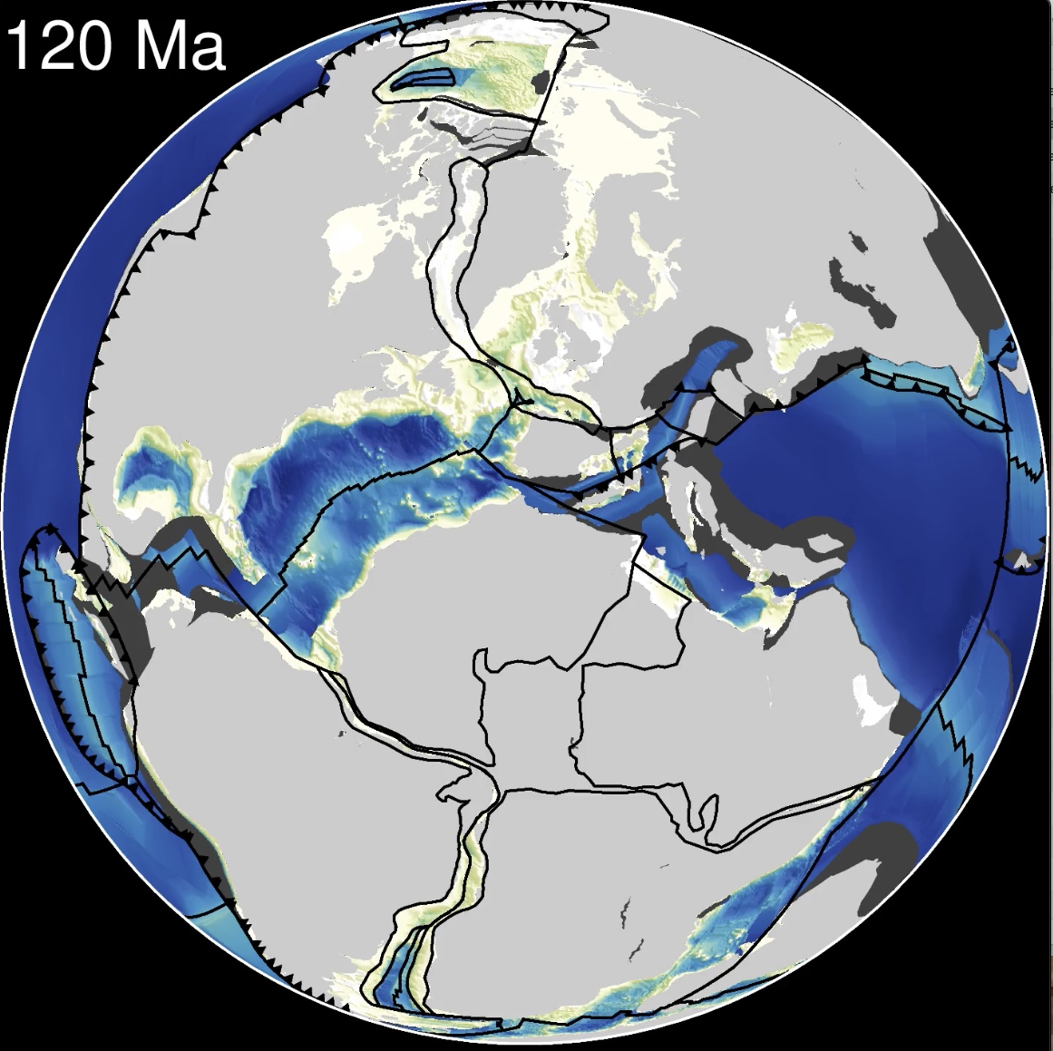
PyBacktrack 1.4 is now available, and adds support for generating paleobathymetry grids from submerged present-day crust.
PyBacktrack is available as a Python package and a Docker image. Installation instructions can be found online in the pyBacktrack documentation.
Changes since version 1.3:
- Can now generate paleobathymetry grids:
- Submerged oceanic and continental present-day crust is backtracked and reconstructed.
- Similar to drill sites, but 2D instead of 1D.
- Continental subsidence model obtains rifting period from builtin rift grids:
- In contrast to drill sites where rifting period is explicitly specified.
- Builtin rift grids:
- Cover all submerged continental crust, and
- are generated from Müller 2019 deforming plate model:
- All submerged crust is assigned a single lithology, whereas drill sites have multiple stratigraphic layers.
- Water depths are negative (below sea level) in paleobathymetry grids, but positive in backtracked drill site output.
- Supports multiple CPUs to reduce running time.
- Submerged oceanic and continental present-day crust is backtracked and reconstructed.
- Supplementary scripts can be installed:
- Previously was `misc/` folder in Github repository, but is now installable.
- Added script to preferentially merge paleobathymetry grids produced by pybacktrack with externally produced paleobathymetry grids (after adding dynamic topography to external grids).
- Added script to generate rift start/end time grids from a global deforming model (used to generate builtin rift grids).
- Added script to extract present day trenches from a global deforming model (used internally to avoid deep bathymetry near trenches).
- Added script to convert sediment thickness into water thickness based on porosity assuming a single “average ocean floor sediment” lithology.
- Backtracking:
- Updated builtin total sediment thickness grid to 2019 version:
- Updated builtin age grid to 2020 version:
- Added “RHCW18” age-to-depth model:
- “Structure and dynamics of the oceanic lithosphere-asthenosphere system“
- Is now the default model (previously was “GDH1”).
- Added Cao2019 dynamic topography models (“AY18” and “KM16”):
- Rift start/end times are no longer required for drill sites on continental crust.
- Now obtained implicitly from builtin rift grids, if not specified explicitly in drill site file.
- Updated example notebooks:
- Added notebook to demonstrate paleobathymetry gridding.
- Added geohistory analysis examples demonstrating backtracking of ocean and shallow continental drill sites.
- Added notebook to demonstrate paleobathymetry gridding.
- Updated functions and classes (API reference):
- New paleobathymetry functions to:
- Generate paleobathymetry by reconstructing and backtracking sediment-covered crust through time,
- write reconstructed paleobathymetry as NetCDF grids.
- Can decompact at any age (not just ages at stratigraphic boundaries).
- Assumes a constant sediment deposition rate within each stratigraphic layer.
- Dynamic topography:
- Now supports multiple point locations:
- Previously supported just a single drill site location.
- Slight change in how grids are interpolated (see notes under DynamicTopography.sample).
- Note: there is only a difference when interpolating between grid times (no difference at grid times).
- New class InterpolateDynamicTopography:
- For just interpolating time-dependent dynamic topography mantle frame grids.
- Used in above-mentioned script for merging paleobathymetry grids.
- Existing class DynamicTopography both reconstructs and interpolates.
- For just interpolating time-dependent dynamic topography mantle frame grids.
- Now supports multiple point locations:
- New paleobathymetry functions to:
Documentation: https://pybacktrack.readthedocs.io/en/latest/
Github: https://github.com/EarthByte/pyBacktrack
Python package: https://pypi.org/project/pybacktrack/
Docker: https://hub.docker.com/r/earthbyte/pybacktrack
![]()

