
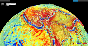
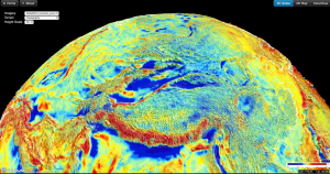
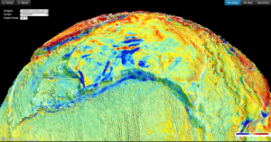
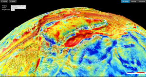
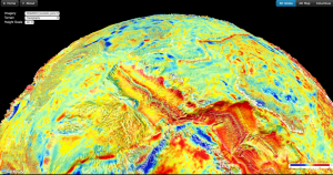
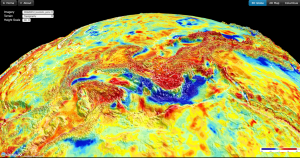
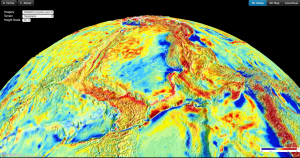
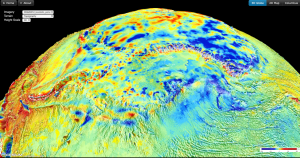
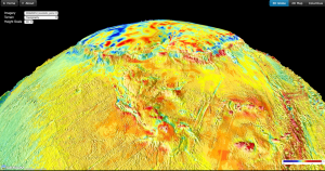
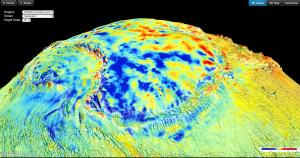
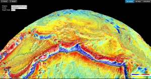
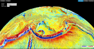
Ready for a fresh start in 2019, our web development guru Michael Chin has created a new interactive virtual gravity globe, based on BGI’s global gravity grids by Bonvalot et al. (2012). The virtual globe allows the user to visualise either Bouguer or isostatic gravity anomalies. The latter has both the effect of surface and Moho topography removed, highlighting the remaining gravity anomalies, which may reflect density anomalies on the crust, mantle lithosphere, or the convecting mantle. The user can choose either high-resolution SRTM15 topography data as terrain model, or the vertical gravity gradient (VGG). By choosing the VGG users are able to evaluate isostatic gravity anomalies in the context of small-scale crustal structures. View the virtual globe here: http://portal.gplates.org/cesium/?view=WGM2012. All you need is a web browser, and interacting with the globe also works on your smartphone or tablet. The globe is particularly useful for a quick interactive exploration of gravity anomalies of sedimentary basins.
![]()
