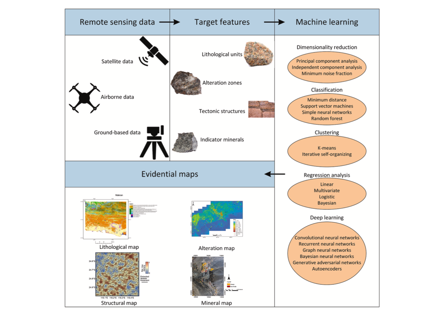

The decline of the number of newly discovered mineral deposits and increase in demand for different minerals in recent years has led exploration geologists to look for more efficient and innovative methods for processing different data types at each stage of mineral exploration. As a primary step, various features, such as lithological units, alteration types, structures, and indicator minerals, are mapped to aid decision-making in targeting ore deposits. Different types of remote sensing datasets, such as satellite and airborne data, make it possible to overcome common problems associated with mapping geological features. The rapid increase in the volume of remote sensing data obtained from different platforms has encouraged scientists to develop advanced, innovative, and robust data processing methodologies. Machine learning methods can help process a wide range of remote sensing datasets and determine the relationship between components such as the reflectance continuum and features of interest. These methods are robust in processing spectral and ground truth measurements against noise and uncertainties. In recent years, many studies have been carried out by supplementing geological surveys with remote sensing datasets, which is now prominent in geoscience research. This paper provides a comprehensive review of the implementation and adaptation of some popular and recently established machine learning methods for processing different types of remote sensing data and investigates their applications for detecting various ore deposit types. We demonstrate the high capability of combining remote sensing data and machine learning methods for mapping different geological features that are critical for providing potential maps. Moreover, we find there is scope for advanced methods such as deep learning to process the new generation of remote sensing data that provide high spatial and spectral resolution for creating improved mineral prospectivity maps.
![]()
