PyBacktrack 1.0: a tool for reconstructing paleobathymetry on oceanic and continental crust

The pyBacktrack software package allows the backtracking of the paleo-water depth of ocean drill sites, providing a framework for reconstructing the accumulation history of sediment components through time. The software incorporates the effects of decompaction of common marine lithologies and allows backtracking of sites on both oceanic and continental crust.  Backtracking on ocean crust is based on … Read more…

Data Processing and Plotting Using 
Generic Mapping Tools (GMT) Course

GMT Course Image 2016

GMT Course Image 2016Course Overview
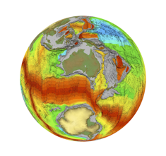
This course is designed to introduce students to different types of spatial data, data processing and interpolation functions and data plotting using GMT (Generic Mapping Tools). GMT is a set of public domain tools that will be used in conjunction with UNIX general processing tools (awk, grep) and basic shell programming. The examples presented in the course will focus on marine geophysical data, however many of the principles are applicable to other scientific data.

The learning outcomes for the course include:  … Read more…

Share

Generic Mapping Tools (GMT)

GMT is an open source collection of about 80 command-line tools for manipulating geographic and Cartesian data sets (including filtering, trend fitting, gridding, projecting, etc.) and producing PostScript illustrations ranging from simple x–y plots via contour maps to artificially illuminated surfaces and 3D perspective views; the GMT supplements add another 40 more specialized and discipline-specific … Read more…