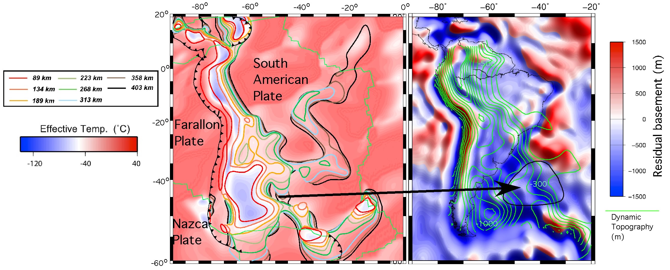
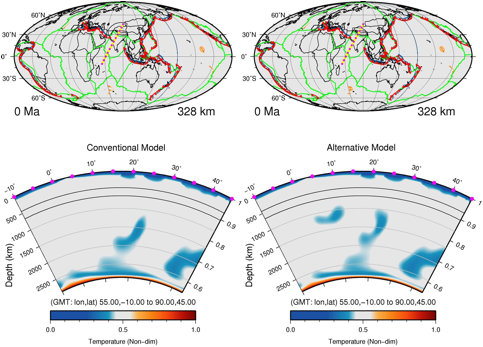
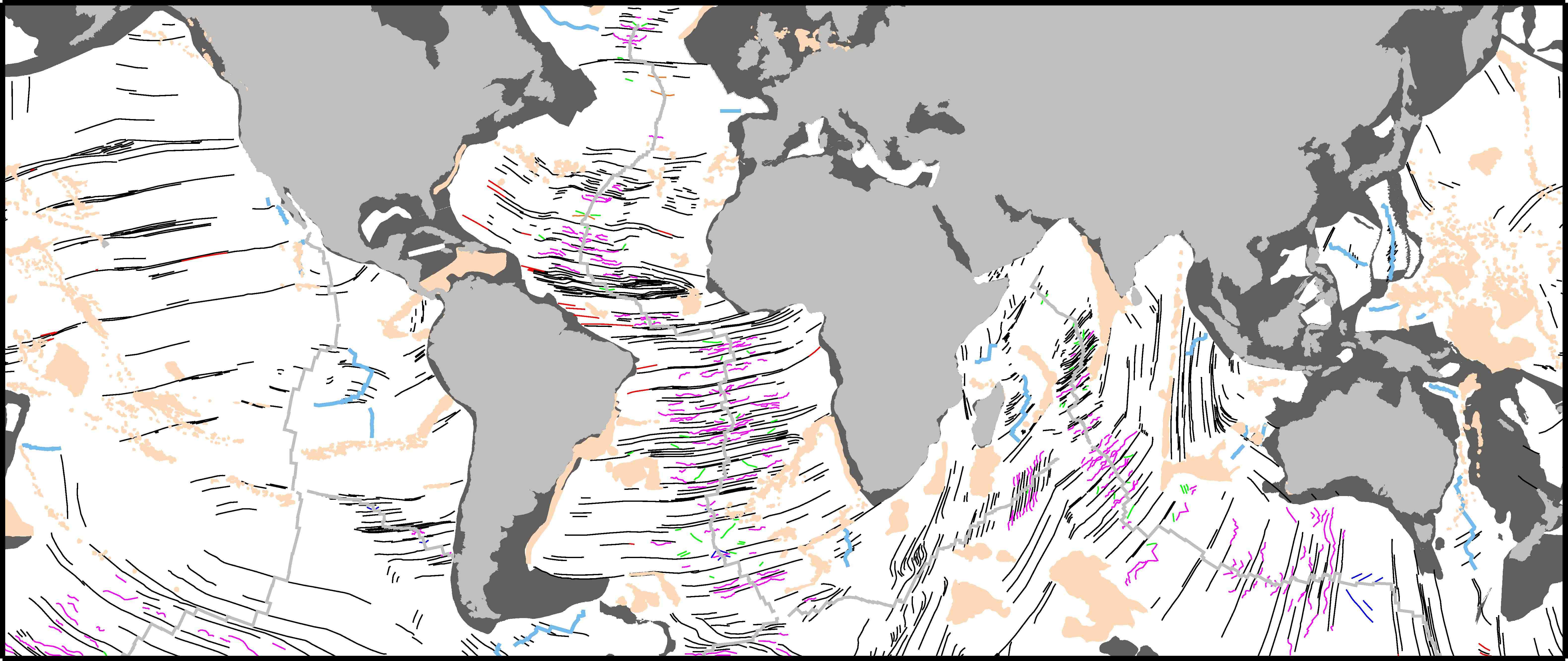
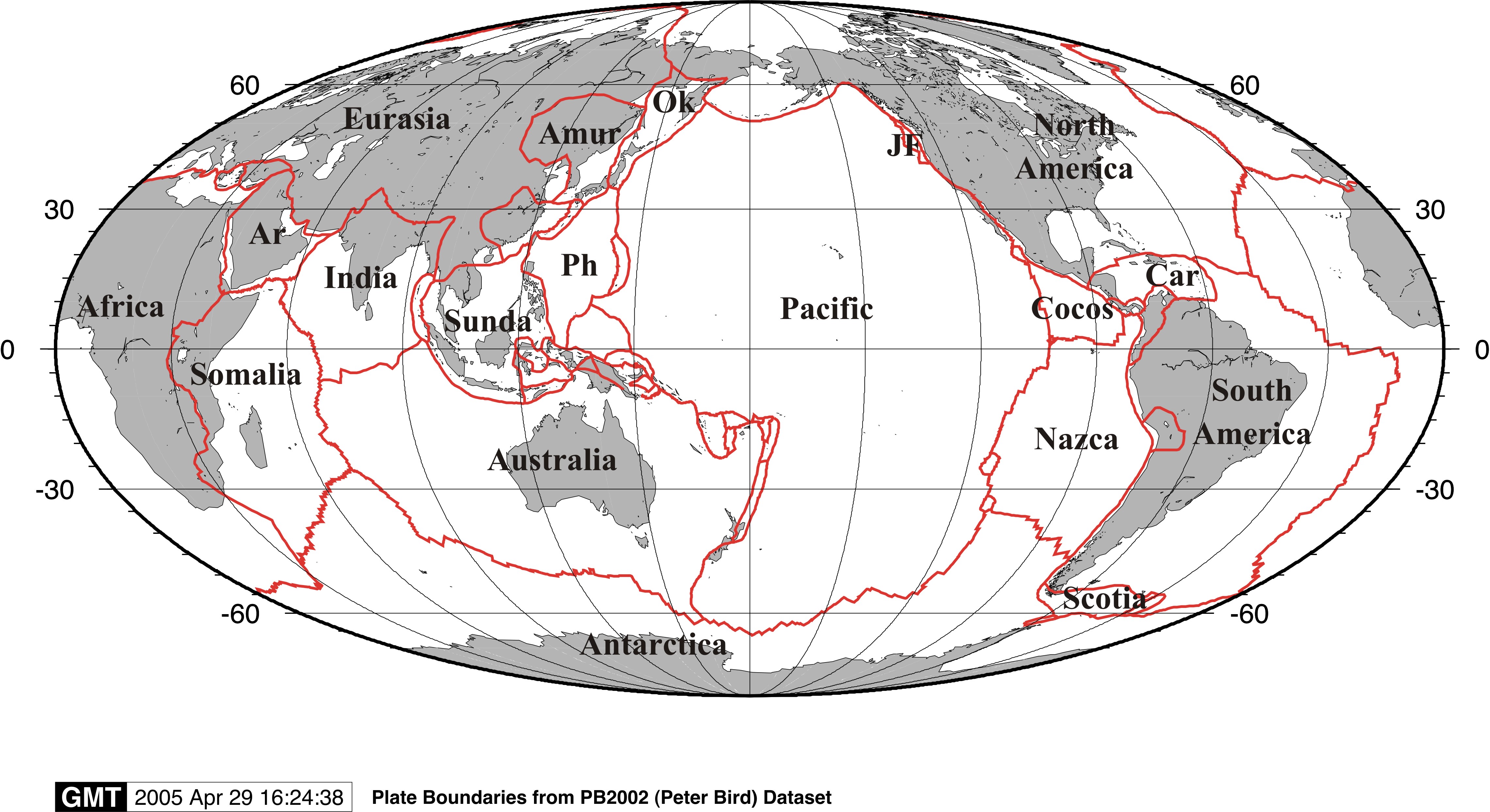
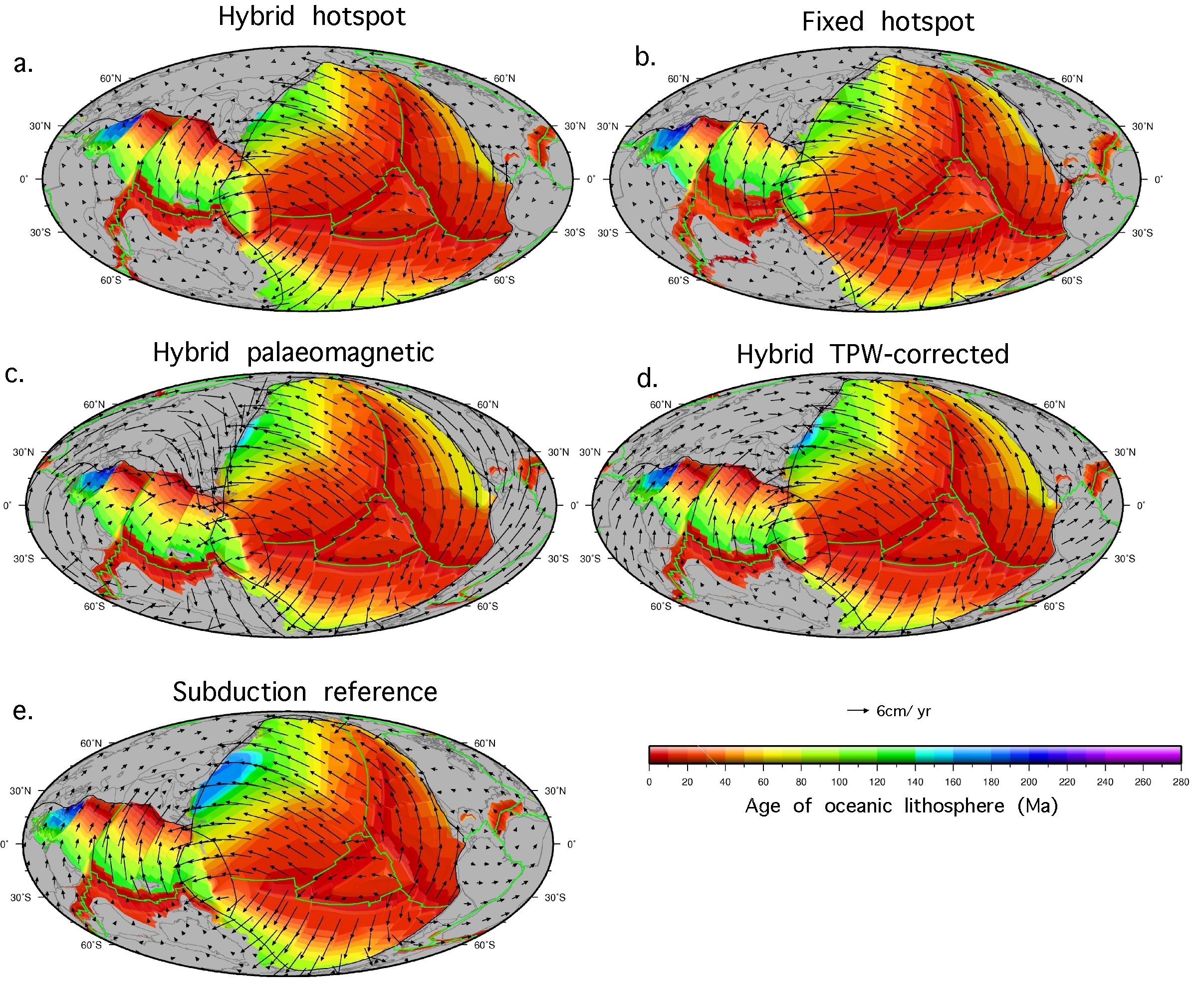
 Absolute reference frames are a means of describing the motion of plates on the surface of the Earth over time, relative to a fixed point or frame. Multiple models of absolute plate motion have been proposed for the Cretaceous-Tertiary period, however, estimating the robustness and limitations of each model remains a significant limitation for refining both regional and global models of plate motion as well as fully integrated and time dependent geodynamic models. Here, we use a novel approach to compare five models of absolute plate motion in terms of their consequences for forward modelled deep mantle structure since at least 140 Ma. … Read more…
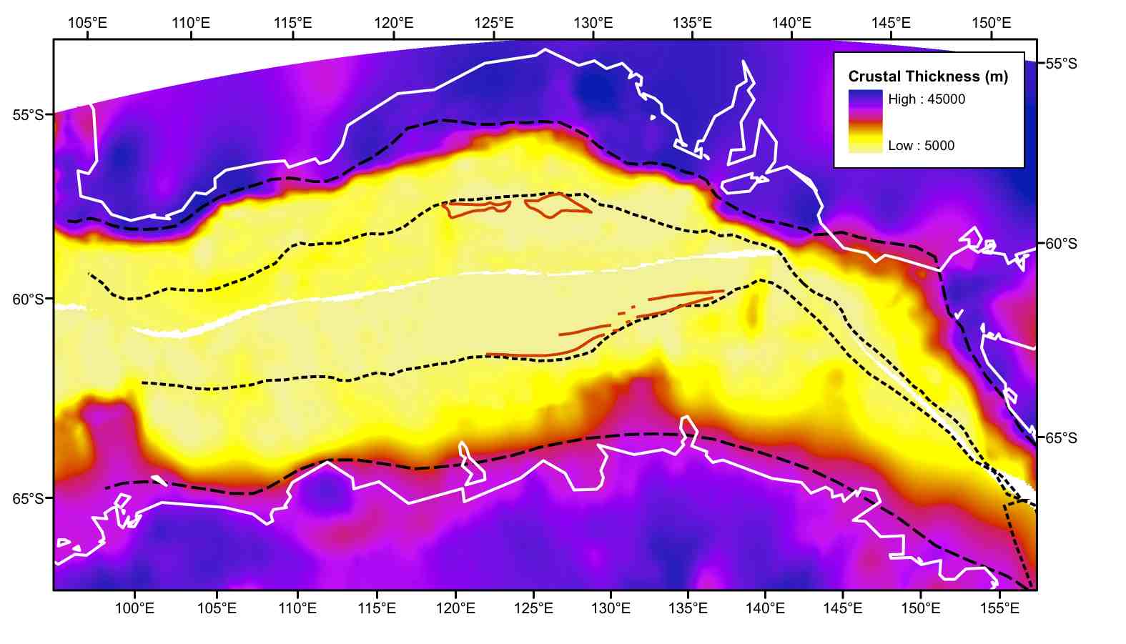
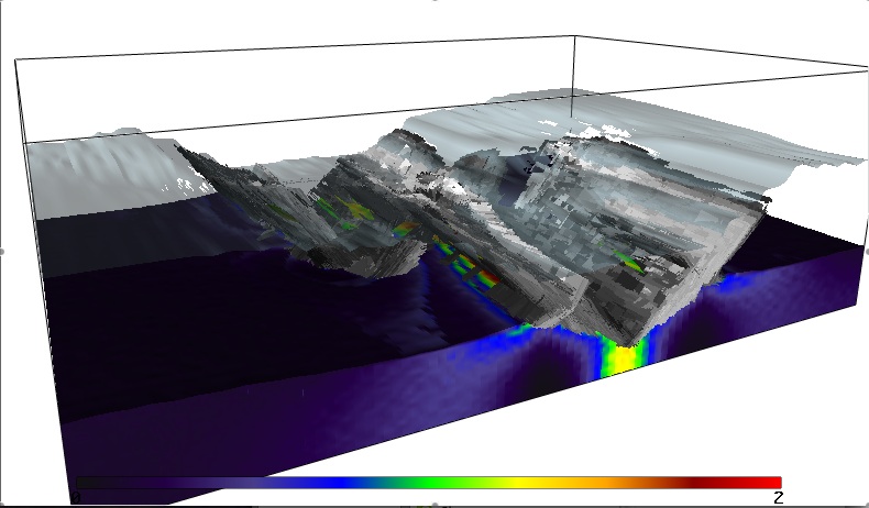
The IntraCONtinental basinS (ICONS) atlas
The ICONS atlas is a collection of basin data for over 240 intracontinental sedimentary basins, displaying crustal structure data, computed extension factors and tectonic subsidence grids and derivatives thereof as well as the dynamic topography evolution of a given basin. The atlas was compiled by Christian Heine as part of his PhD project investigating the formation and … Read more…