 Citation
Whittaker, J. M., Afonso, J. C., Masterton, S., Müller, R. D., Wessel, P., Williams, S. E., & Seton, M. (2015). Long-term interaction between mid-ocean ridges and mantle plumes. Nature Geoscience, 8(6), 479-483.
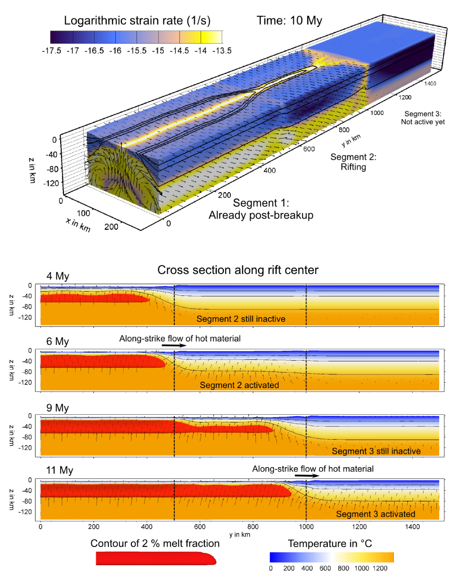
Summary
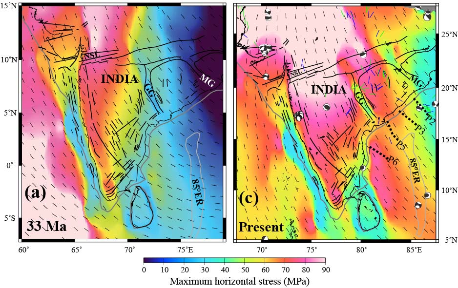
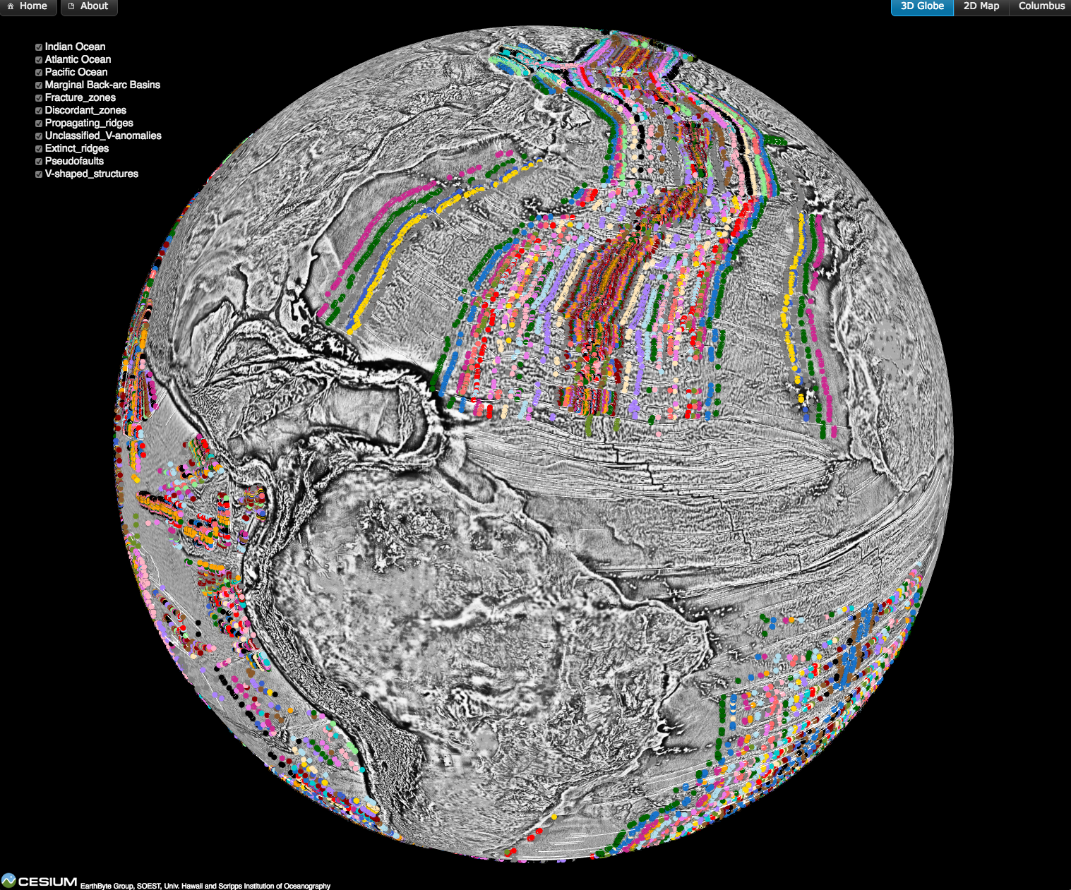
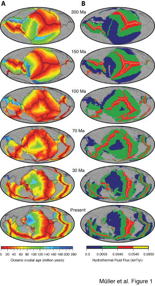
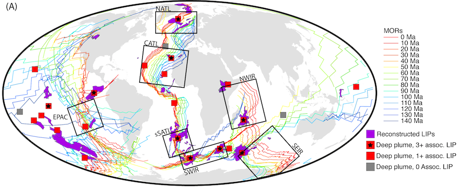
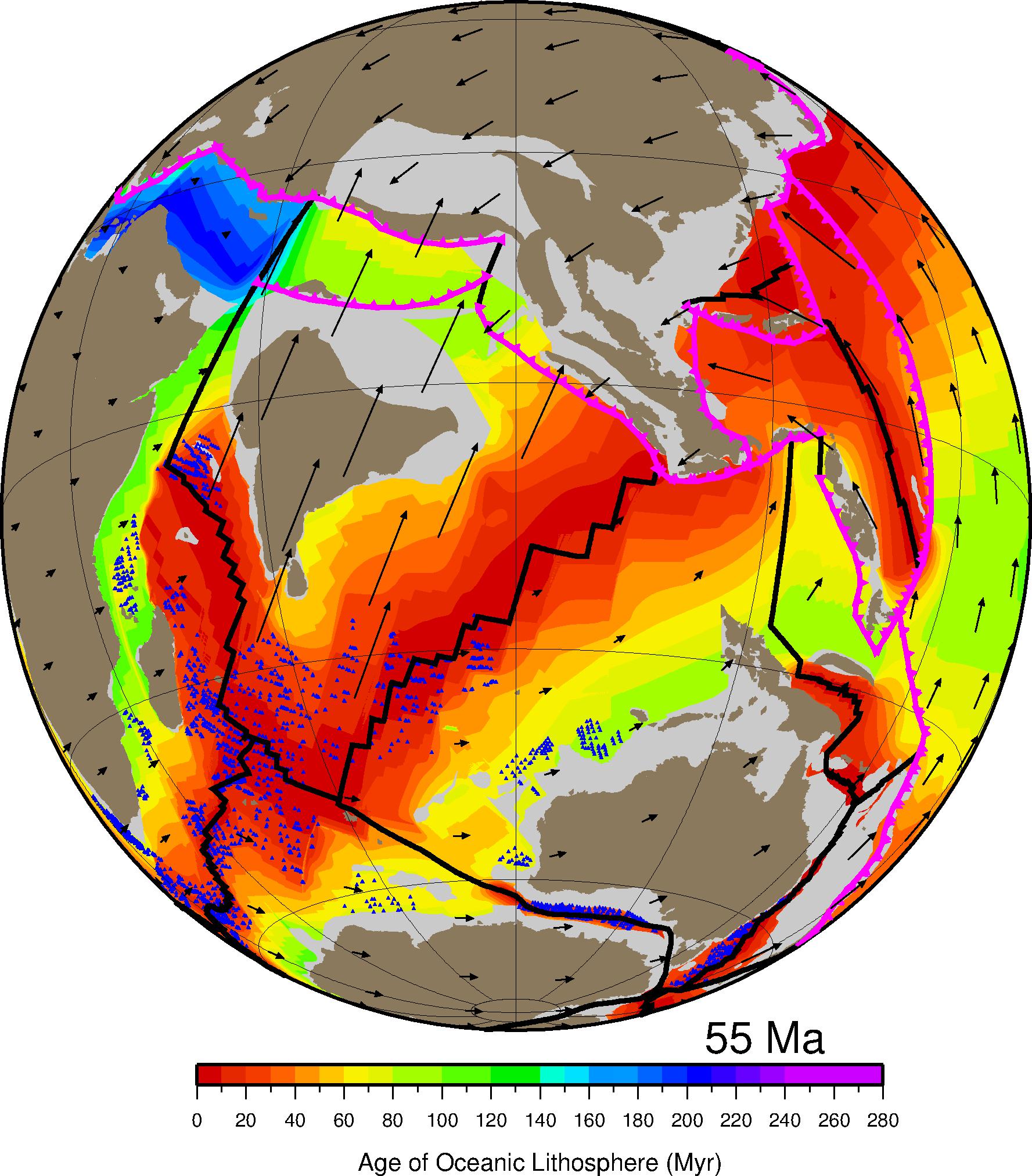
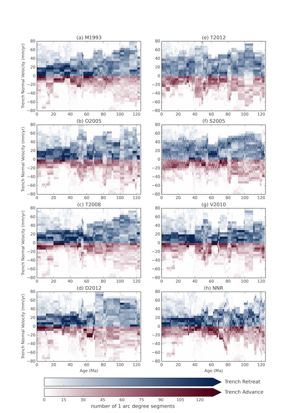
Plate tectonic motions are commonly considered to be driven by slab pull at subduction zones and ridge push at mid-ocean ridges, with motion punctuated by plumes of hot material rising from the lower mantle. Within this model, the geometry and location of mid-ocean ridges are considered to be independent of lower-mantle dynamics, such as deeply sourced plumes that produce voluminous lava eruptions-termed large igneous provinces. Here we use a global plate model to reconstruct the locations of large igneous provinces relative to plumes and mid-ocean ridges at the time they formed. … Read more…

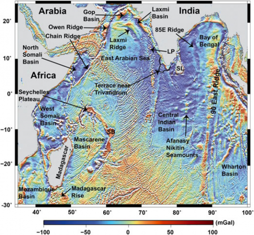
 The
The