
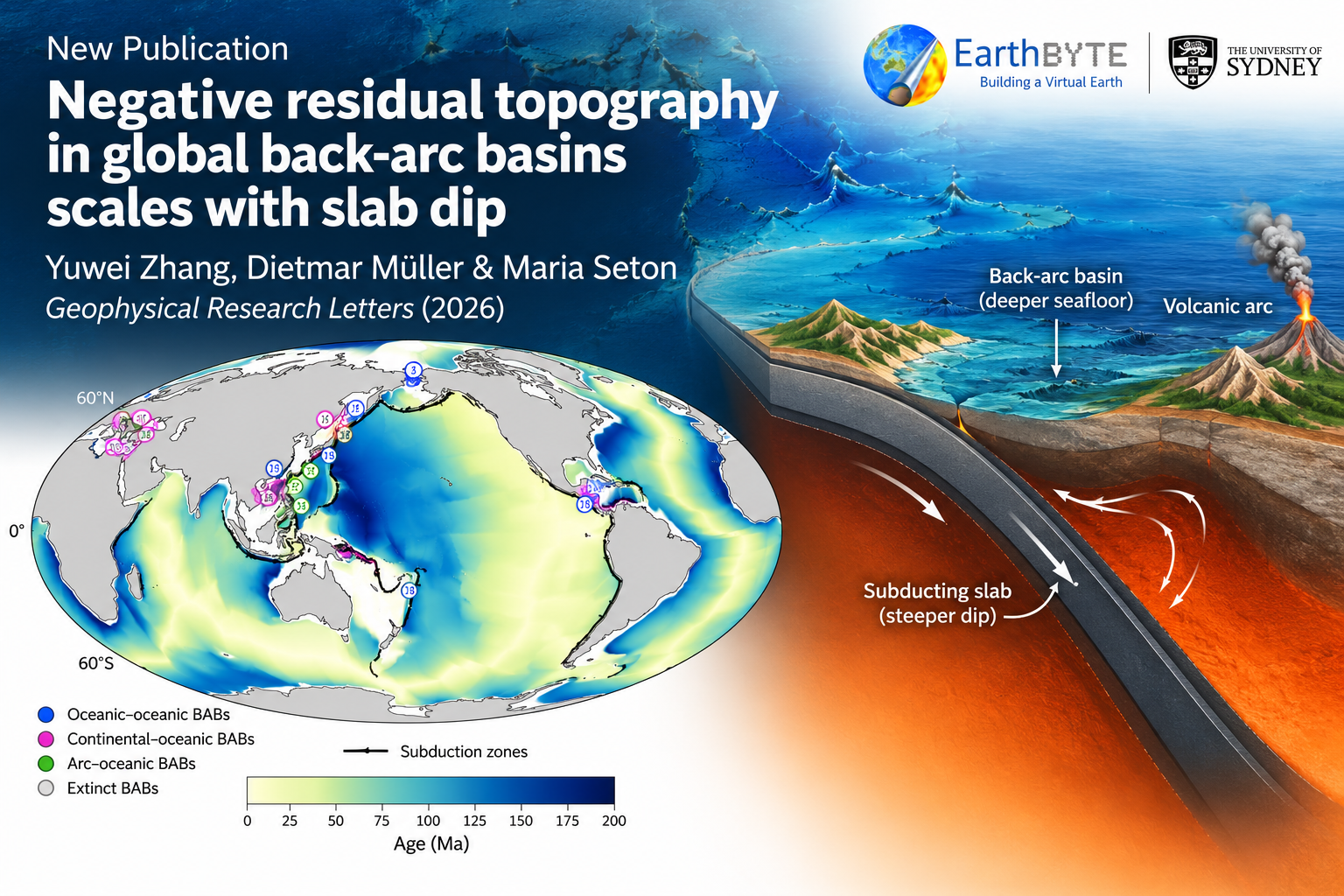
Researchers measured the height of the seafloor in back-arc basins around the world after correcting for sediment, crustal structure and plate age, to work out how much of that height is due to deeper mantle processes. They found that most of these basins sit lower than expected, and this effect gets stronger where the subducting slab is steeper, with continental-oceanic settings showing larger effects than ocean-ocean ones. The anomaly also relates to how much water has been carried into the mantle by the slab, suggesting subduction geometry and hydration influence mantle flow beneath back-arc regions.
Abstract. Dynamic topography above subduction zones is widely inferred, but its magnitude and controls remain poorly constrained at the global scale. Here, we estimate residual topography across a range of back‐arc basins by correcting bathymetry for sediment loading, crustal structure, and lithospheric age, and compare the anomalies with slab geometry and subduction parameters. Most basins show negative residual topography, and the anomalies become more negative with increasing slab dip. Continental–oceanic back‐arc basins tend to show more negative residual topography than ocean–ocean systems. Residual topography further covaries with cumulative subducted water content, consistent with a possible influence of hydration‐modified mantle rheology on slab‐driven flow. Although the number of basins with complete slab constraints remains limited, these results suggest that slab geometry is associated with negative residual topography in back‐arc regions and provide observational constraints for geodynamic models of mantle flow around subduction zones.
- The data sets generated in this study are available at https://doi.org/10.5281/zenodo.22760146.
- The cumulative water is calculated by a workflow at https://github.com/EarthByte/water_subduction.
- The Plate Reconstruction Tool (GPlately) is available at https://www.github.com/GPlates/gplately.
- The Generic Mapping Tool GMT is freely available from https://www.generic‐mapping‐tools.org.
- The Slab2 model is available from https://www.usgs.gov/data/slab2‐a‐comprehensive‐subduction‐zone‐geometry‐model.

