
Scientists drilling into the Tyrrhenian Sea seafloor as part of the International Ocean Discovery Program recovered rock cores showing granite intrusions mixed with peridotite along an ancient detachment fault. Dating and chemical analysis show the granites formed about 4 million years ago some 7 to 9 kilometres down, then were rapidly brought to the seafloor within roughly half a million years. The results suggest that weak granitic rocks can focus deformation along detachment faults, speeding up mantle exhumation during continental breakup and the birth of new ocean basins.
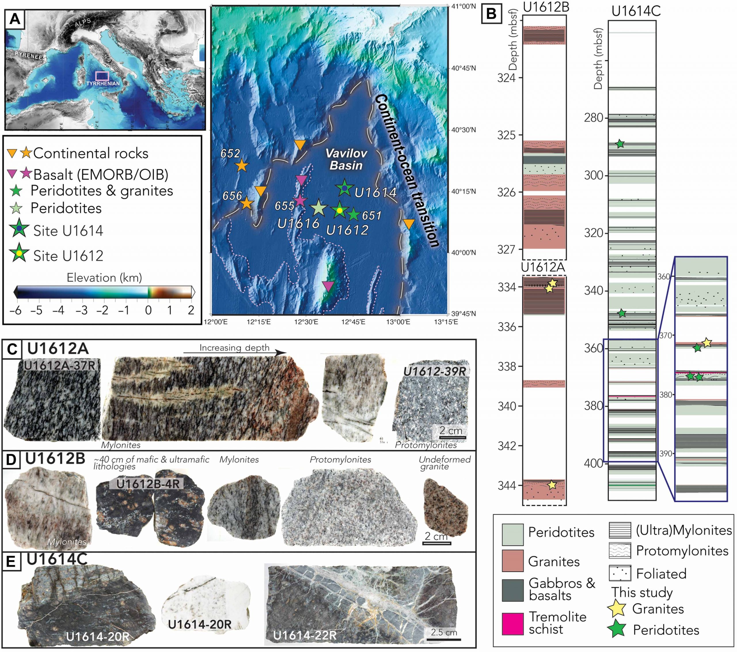
Abstract. Serpentinization and magmatism weaken the lithosphere and facilitate mantle exhumation during magma-poor rifting and ultraslow seafloor spreading. However, the complex interplay and timing among these competing mechanisms along detachment faults remain poorly constrained. The International Ocean Discovery Program (IODP) Expedition 402 drilled an incipient oceanic basin in the Tyrrhenian Sea offshore Italy. Recovered cores consist of one sequence of variably deformed granitic intrusions intercalated with slivers of peridotites and another of primarily serpentinized peridotites with heterogeneous deformation and local granitic intrusions. Geochronological and geochemical data reveal that the granites crystallized at 4 million years ago at a depth of ~7 to 9 kilometers and rapidly exhumed within ~0.5 million years, requiring exhumation rates of ~2 centimeters per year. Structural observations show that these granites accommodated significant postcrystallization strain and enhanced localization of detachment faulting. Stable isotopes record serpentinization temperatures of ~200°C, suggesting that serpentinization occurred after the emplacement and deformation of granites. We conclude that weak felsic rocks may enhance strain localization along detachment faults at intermediate depths and aid continental breakup and mantle exhumation.
Code and data: Zenodo: 10.5281/zenodo.18893357

