Modelling global precipitation since 250 million years ago
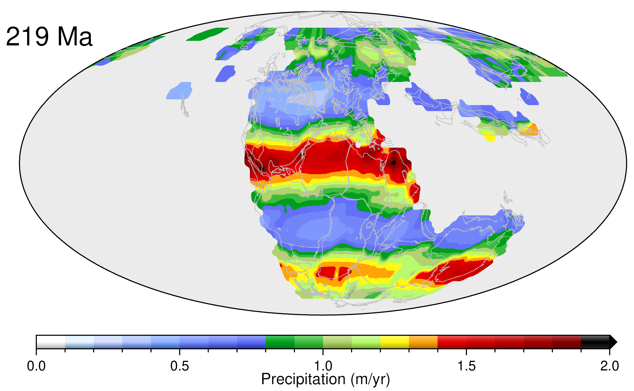
We have developed a novel data-driven approach to reconstruct precipitation patterns through geological time, since the supercontinent Pangea was in existence. Our approach involves linking climate-sensitive sedimentary deposits such as coal, evaporites and glacial deposits to a global plate model, reconstructed paleo-elevation maps and high-resolution General Circulation Models via Bayesian machine learning. We model the … Read more…