Carbonate platform evolution in response to the Mid – Pleistocene climate transition on the North-West Shelf of Australia: Insights from forward stratigraphic modelling
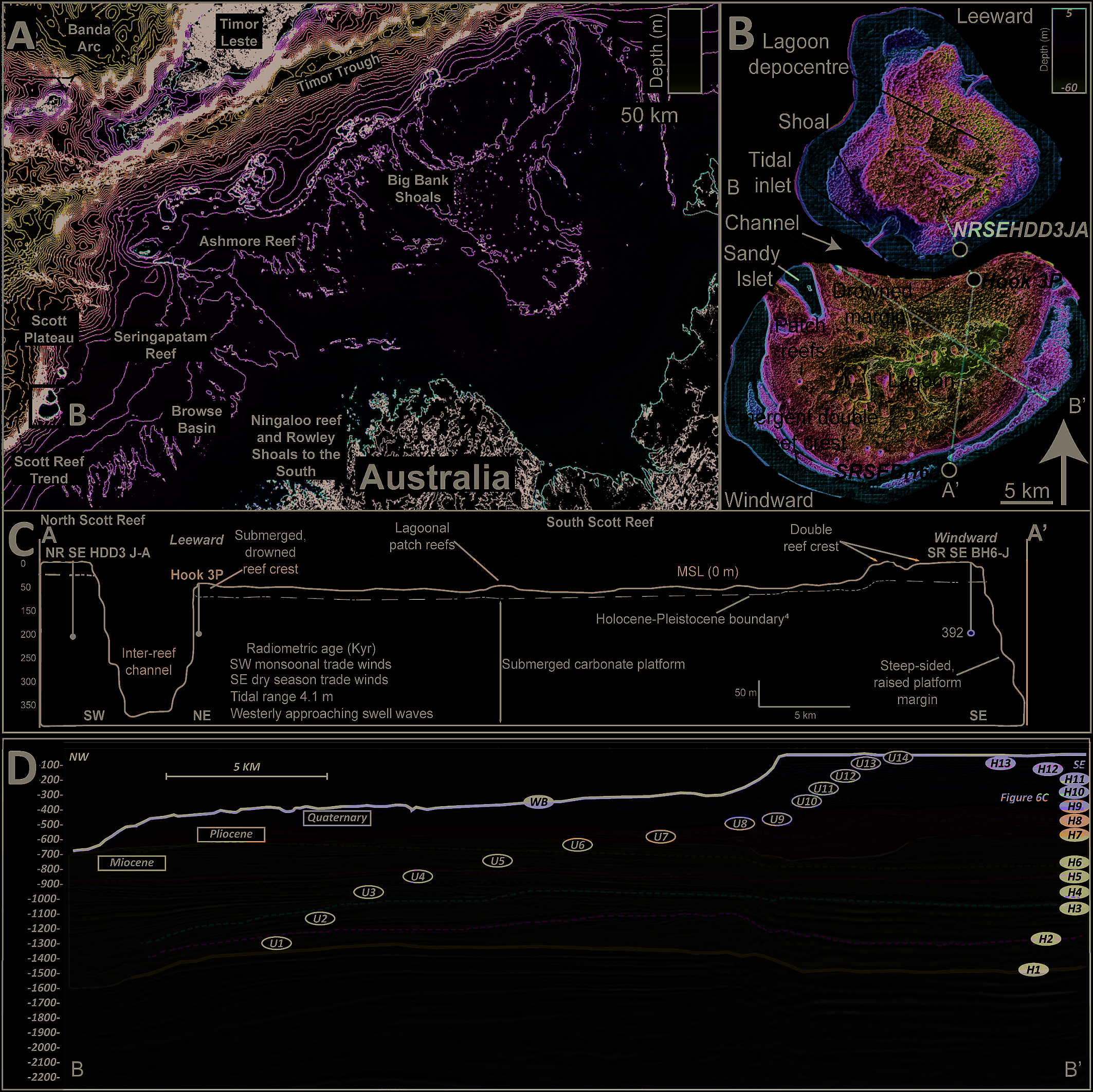
Regional bathymetric map showing Scott Reef's location on Australia's Northwest Shelf relative to nearby reefs and tectonic features.

Researchers used forward stratigraphic modelling to reconstruct how Scott Reef, on Australia's Northwest Shelf, grew and changed shape during the Middle Pleistocene Transition, a period when ice age cycles became longer and more extreme. They found that a major sea-level fall around 1.2 million years ago exposed and karstified the reef, while a later long … Read more…
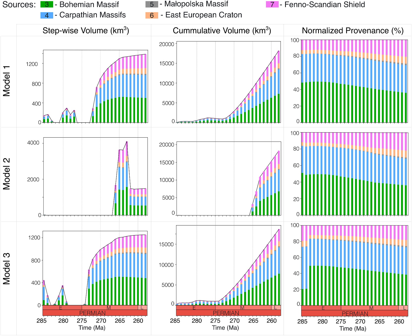
Evolution and Provenance of the Polish Rotliegend in the Southern Permian Basin

3D reconstruction of the Polish Trough at 256 million years ago showing sediment provenance areas, thickness and drainage systems.

Researchers used an open-source landscape and stratigraphic evolution model (goSPL) to simulate how sediment filled the Polish Trough, part of the Southern Permian Basin, between 285 and 256 million years ago. By testing six different tectonic and climate scenarios, they identified two models that best match known sediment volumes, hiatus timing and depositional depth, and … Read more…

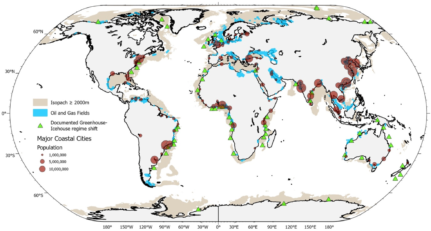
Impact of Cenozoic sea-level fluctuations on passive margin stratigraphic architecture: Implications for underground hydrogen storage potential

Global map showing passive margins with thick sedimentary successions and greenhouse–icehouse regime shifts relevant to hydrogen storage potential.

This study used forward stratigraphic modelling of the Hunter offshore margin in New South Wales to examine how Cenozoic sea-level changes shaped the layering of sediments on passive continental margins. The results show that warm 'greenhouse' periods produced thick, continuous sediment layers good for storing gases, while colder 'icehouse' periods produced thinner, stacked layers that … Read more…

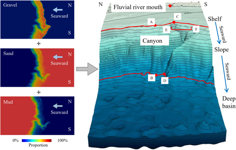
Geomorphology: Combining stratigraphic forward modeling and susceptibility mapping to investigate the origin and evolution of submarine canyons

The debate on the submarine canyon origin between the upslope erosion model dominated by retrogressive mass failures and the downslope erosion model controlled by gravity flows has not been fully settled. However, this debate is critical for explaining submarine canyon evolution. This study combines susceptibility mapping and stratigraphic forward modeling (SFM) to examine the origin … Read more…