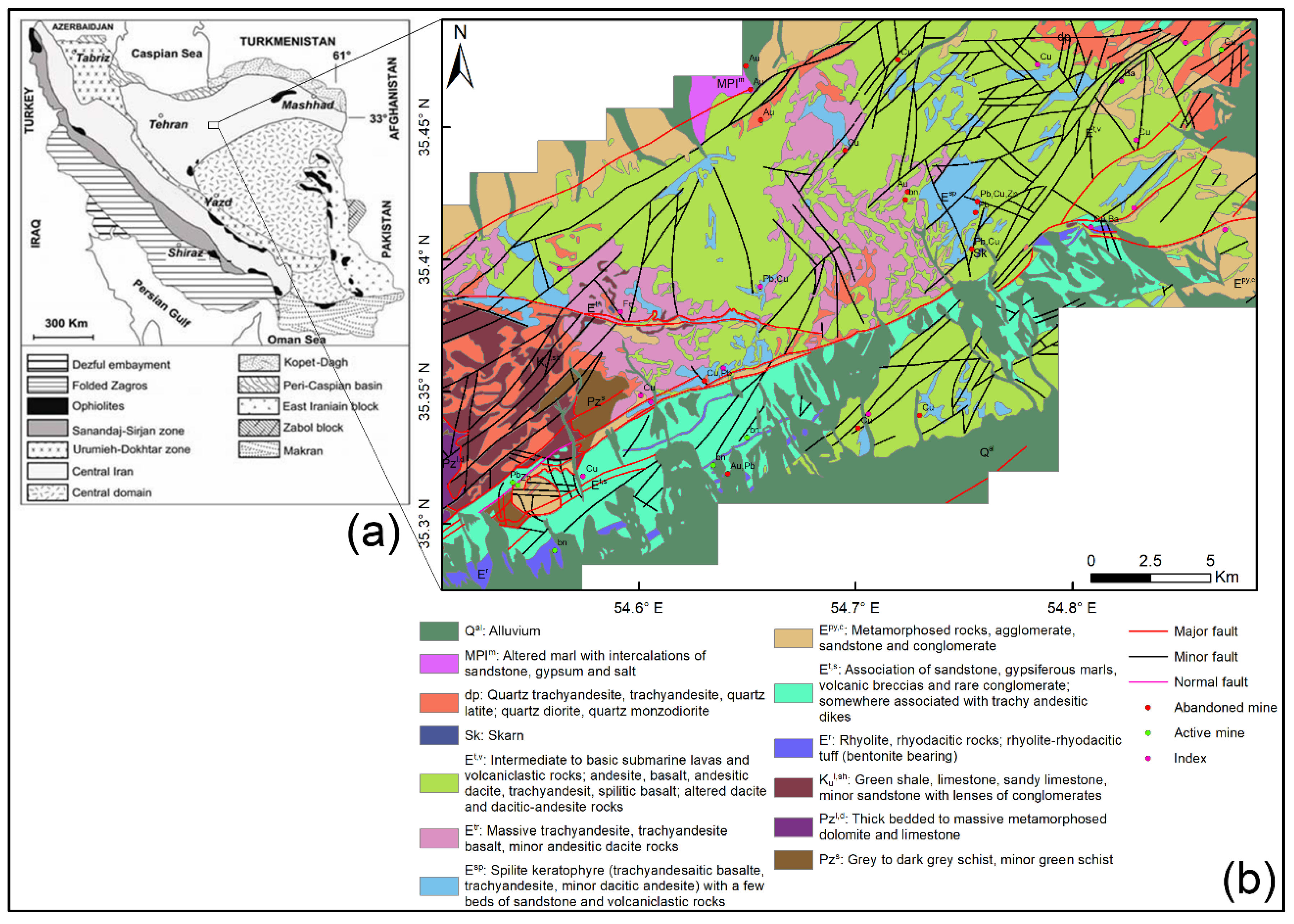
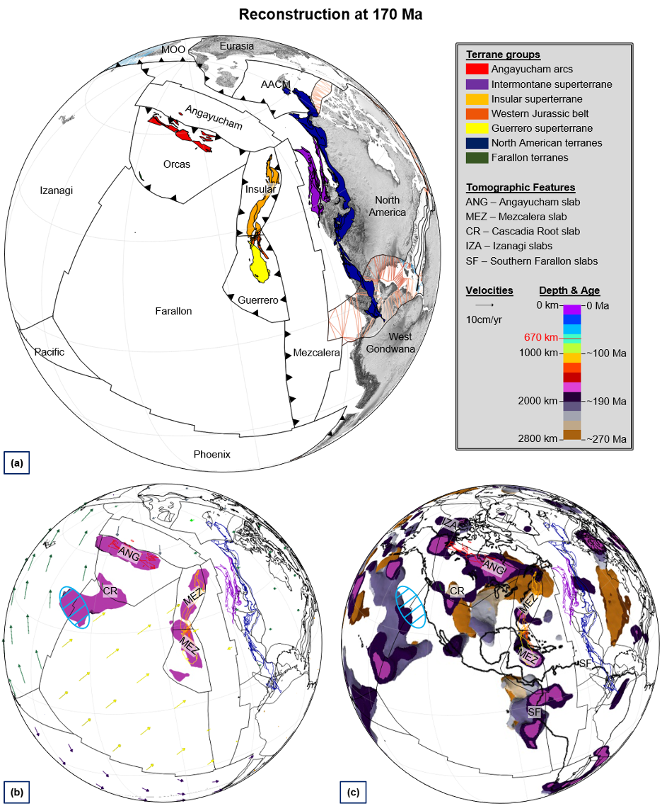
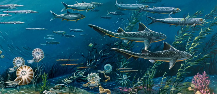
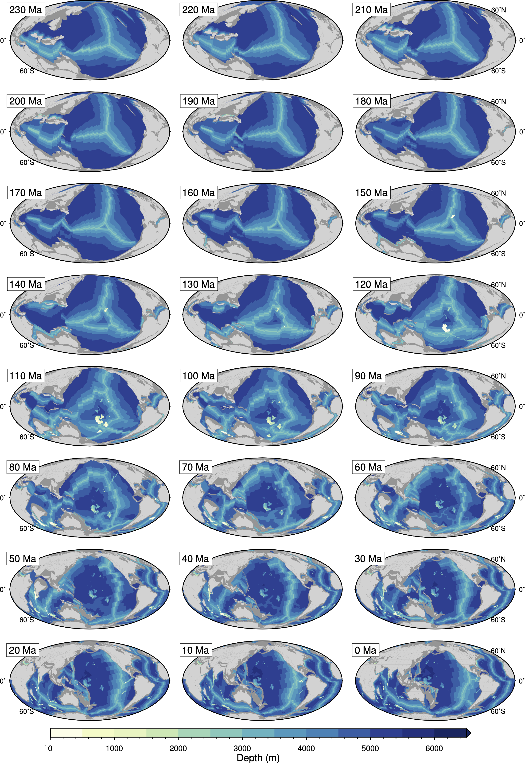
Earth processes over geological timescales cannot be understood outside of a plate tectonic context.
However, no standard tool exists to explore the causes and effects of lithosphere-mantle interaction
in accordance with past plate configurations. Our aim is to develop a Palaeo-Geographic
Information System called EarthByte that will connect the open source and architectureindependent
GPlates and GMT software, and implement XML-based service interfaces and
databases. EarthByte will create the foundation for an e-geoscience framework for grid-based data
access and Earth process modelling by linking geological and geophysical observations to
palaeogeographic models for constraining mantle convection and lithospheric deformation.

This figure shows the partner organisations of EarthByte and the type of service that each organisation will provide. ACcESS=Australian
Computational Earth Science Simulator; AWI=Alfred Wegener Institute for Polar Research; CalTech CIG=California
Institute of Technology, Computational Infrastructure for Geodynamics; CHRONOS=Interactive Network of Data and
Tools for Earth System History; IFREMER=French Institute of Research and Exploitation of the Sea;
Monash=Monash University; NERC=Natural Env. Research Council Data Grid; NGU=Norwegian Geol. Survey;
ORI=Ocean Research Institute; pmd*CRC=Predictive Mineral Discovery Cooperative Research Centre; Scripps
PRAGMA=Scripps, Pacific Rim Applications and Grid Middleware Assembly; SOEST=School of Ocean and Earth
Science and Technology, University of Hawaii; TSRC=Tectonics Special Research Centre; Univ. Geosciences=Univ. of
Geosciences, Wuhan, China; USyd=University of Sydney; UTIG=Institute of Geophysics, Univ. of Texas at Austin.
EarthByte Document Downloads
Click here for a copy of the EarthByte e-Research Strategy Document 
Click here for a copy of the EarthByte e-Research Pilot Research Proposal 
Publications
List of publications related to project will be updated shortly.
Project Contact Person
A/Prof. Dietmar Müller