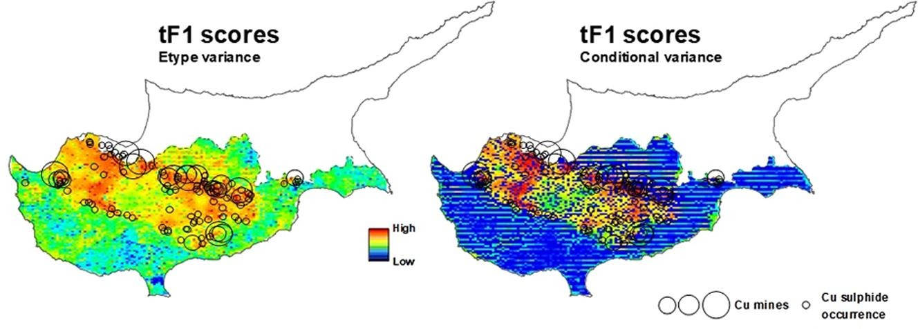
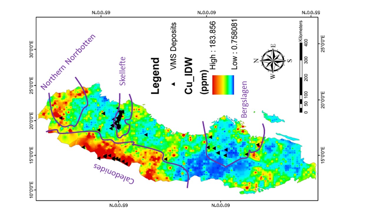
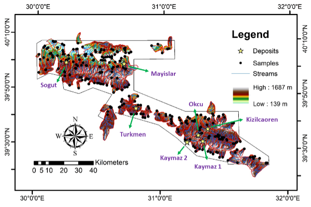
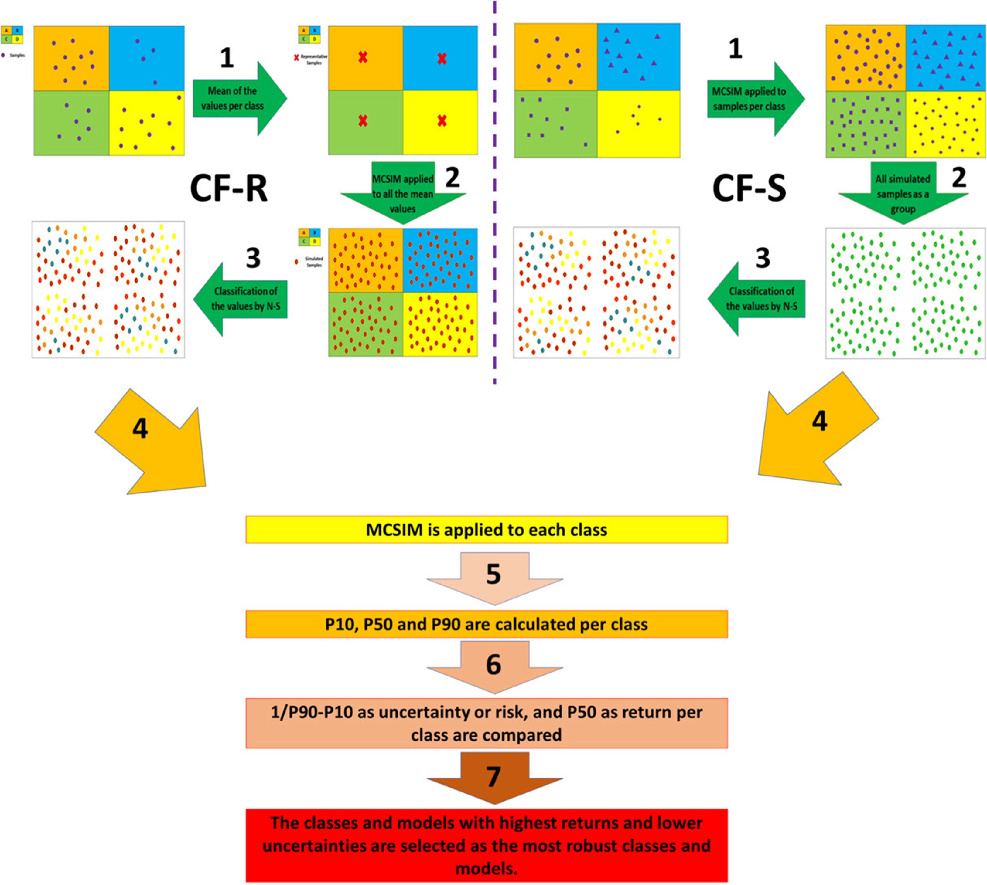
Geochemical anomaly definition using stream sediments landscape modeling
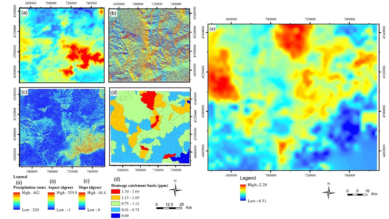
A new research paper published in Ore Geology Reviews based on a collaboration between Dr. Behnam Sadeghi from EarthByte Group, USYD, and several research institutes in China, including: China University of Geosciences: State Key Laboratory of Geological Processes and Mineral Resources Hebei GEO University: 1) Institute of Resource and Environmental Engineering, 2) Hebei Key Laboratory … Read more…